Area Overview for LE6 0QY
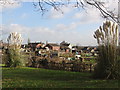
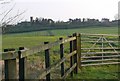
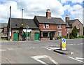
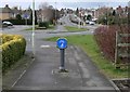
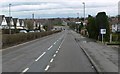
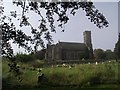
Photos of LE6 0QY


Area Information
Living in LE6 0QY offers a quiet, residential experience in a small cluster of homes nestled in the English countryside. With a population of 2,093, this area feels intimate, where daily life is shaped by proximity to nearby towns and a mix of practical amenities. The postcode lies near Leicester, offering easy access to urban conveniences while retaining a village-like character. Residents benefit from a balance of small-scale retail and transport links, including a rail station and metro stops. The area’s low flood risk and minimal planning constraints make it a stable choice for those seeking a settled lifestyle. Its compact size means neighbours are likely to know one another, fostering a sense of community. For buyers, the focus here is on family-friendly living, with homes primarily occupied by owners rather than renters. The presence of local shops and transport options ensures daily needs are met without the need for long commutes. LE6 0QY is not a place for those seeking fast-paced city life but suits those who value tranquillity, security, and a manageable pace of living.
- Area Type
- Postcode
- Area Size
- Not available
- Population
- 2093
- Population Density
- 3196 people/km²
The property market in LE6 0QY is characterised by high home ownership (90%) and a focus on houses rather than flats or apartments. This suggests a market driven by owner-occupiers rather than landlords, with properties likely to be family homes or long-term investments. The small population and compact size of the area mean the housing stock is limited, but the emphasis on single-family homes implies a stable, low-turnover market. Buyers should expect a quiet, unassuming environment where properties are not subject to the pressures of high-density development. The absence of planning constraints such as protected woodlands or AONB designations means there is no restriction on property modifications or extensions, which could be a benefit for those seeking to customise their homes. However, the small size of the area means competition for available properties may be limited, and buyers should consider proximity to nearby towns for additional amenities.
House Prices in LE6 0QY
No properties found in this postcode.
Energy Efficiency in LE6 0QY
Residents of LE6 0QY have access to a range of nearby amenities that support daily life. Local retail options include Co-op Groby and Morrisons Glenfield, providing essential groceries and household supplies. The area’s proximity to Leicester North and Rothley metro stations, along with the Leicester Railway Station, ensures easy access to public transport for commuting or leisure. While the area itself is small, the surrounding region offers a variety of services, from dining to leisure facilities. The presence of multiple retail outlets and transport hubs suggests a practical, community-focused lifestyle where residents can meet their needs without long journeys. The mix of retail and transport options contributes to a convenient, low-stress environment, ideal for those who prioritise accessibility and simplicity in their daily routines.
Amenities
Schools
| Rank | School | Type | Entry gender | Ages |
|---|
Explore more schools in this area
Go to Schools tabDemographics
The community in LE6 0QY is predominantly composed of adults aged 30–64, with a median age of 47. This suggests a mature, stable population, likely focused on long-term residency rather than transient living. Home ownership is exceptionally high at 90%, indicating a strong preference for property investment over rental housing. The area is largely composed of houses, not flats, which aligns with the demographics of older, established households. The predominant ethnic group is White, with no data provided on other groups, though this does not necessarily reflect a lack of diversity. The low population—just over 2,000 people—means the area is small enough to feel close-knit, with limited deprivation indicators. This translates to a quality of life where essential services are accessible, and the community is likely to be cohesive. The age profile suggests a mix of professionals, retirees, and families, all contributing to a steady, low-risk environment for living.
Household Size
Accommodation Type
Tenure
Ethnic Group
Religion
Household Composition
Age
Household Deprivation
NS-SEC
Explore more demographic insights in this area
Go to Demographics tabPlanning
Planning Constraints
- Flood RiskPremium
- Ramsar Wetland SitesPremium
- Area of Outstanding Natural BeautyPremium
- Protected Nature ReservePremium
- Protected WoodlandPremium