Area Overview for LE6 0LB
Photos of LE6 0LB
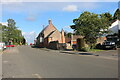
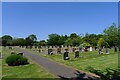
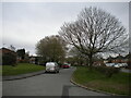
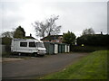
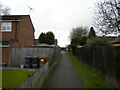
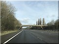
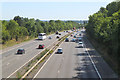
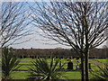
41 photos from this area
Area Information
Key information about the LE6 0LB including its size, population, and administrative classification.
- Area Type
- Postcode
- Area Size
- 1.1 hectares
- Population
- 1204
- Population Density
- 270 people/km²
House Prices in LE6 0LB
21
Properties
£106,738
Average Sold Price
£43,425
Lowest Price
£181,000
Highest Price
Showing 21 properties
| Address | Type | Beds | Baths | Last Sale Price | Last Sale Date | |
|---|---|---|---|---|---|---|
| 11 Bradgate Drive, Ratby, LE6 0LB | house | - | - | £140,000 | Dec 2020 | |
| 23 Bradgate Drive, Ratby, LE6 0LB | Bungalow | 2 | 1 | £115,000 | Feb 2020 | |
| 13 Bradgate Drive, Ratby, LE6 0LB | Semi-detached | 3 | 1 | £181,000 | Apr 2017 | |
| 25 Bradgate Drive, Ratby, LE6 0LB | Semi-detached | - | - | £100,000 | Aug 2005 | |
| 41 Bradgate Drive, Ratby, LE6 0LB | Semi-detached | - | - | £61,000 | Jul 2001 | |
| 39 Bradgate Drive, Ratby, LE6 0LB | Terraced | - | - | £43,425 | Feb 2000 | |
| 15 Bradgate Drive, Ratby, LE6 0LB | house | - | - | - | - | |
| 45 Bradgate Drive, Ratby, LE6 0LB | Bungalow | - | - | - | - | |
| 33 Bradgate Drive, Ratby, LE6 0LB | house | - | - | - | - | |
| 31 Bradgate Drive, Ratby, LE6 0LB | Terraced | - | - | - | - |
Page 1 of 3
Energy Efficiency in LE6 0LB
Amenities
Schools
| Rank | School | Type | Entry gender | Ages |
|---|
Explore more schools in this area
Go to Schools tabDemographics
Household Size
Two person
most common
Accommodation Type
Houses
most common
Tenure
62
majority
Ethnic Group
White
most common
Religion
N/A
most common
Household Composition
N/A
most common
Age
47
median
Adults (30-64 years)
most common
Household Deprivation
N/A
with no deprivation
NS-SEC
26
in Lower managerial occupations
Explore more demographic insights in this area
Go to Demographics tabPlanning
Planning Constraints
- Flood RiskPremium
- Ramsar Wetland SitesPremium
- Area of Outstanding Natural BeautyPremium
- Protected Nature ReservePremium
- Protected WoodlandPremium