Area Overview for LE6 0JW
Photos of LE6 0JW
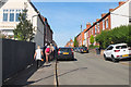


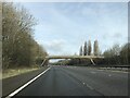
41 photos from this area
Area Information
Key information about the LE6 0JW including its size, population, and administrative classification.
- Area Type
- Postcode
- Area Size
- 4419 m²
- Population
- 1701
- Population Density
- 544 people/km²
House Prices in LE6 0JW
13
Properties
£242,220
Average Sold Price
£122,000
Lowest Price
£352,500
Highest Price
Showing 13 properties
| Address | Type | Beds | Baths | Last Sale Price | Last Sale Date | |
|---|---|---|---|---|---|---|
| 1 Nook Close, Ratby, LE6 0JW | Detached | 3 | 1 | £280,000 | Sep 2025 | |
| 11 Nook Close, Ratby, LE6 0JW | Detached | 4 | 2 | £352,500 | Jul 2025 | |
| 4 Nook Close, Ratby, LE6 0JW | Semi-detached | 1 | 1 | £270,000 | Dec 2024 | |
| 9 Nook Close, Ratby, LE6 0JW | Detached | 3 | 1 | £295,000 | May 2024 | |
| 3 Nook Close, Ratby, LE6 0JW | Semi-detached | 3 | 1 | £240,000 | Dec 2023 | |
| 2 Nook Close, Ratby, LE6 0JW | house | - | - | £252,500 | Oct 2022 | |
| 8 Nook Close, Ratby, LE6 0JW | Detached | 3 | 2 | £272,000 | Sep 2022 | |
| 14 Nook Close, Ratby, LE6 0JW | Detached | - | - | £167,000 | Sep 2006 | |
| 12 Nook Close, Ratby, LE6 0JW | Detached | - | - | £171,200 | Feb 2004 | |
| 10 Nook Close, Ratby, LE6 0JW | Detached | 3 | 1 | £122,000 | Jul 2002 |
Page 1 of 2
Energy Efficiency in LE6 0JW
Amenities
Schools
| Rank | School | Type | Entry gender | Ages |
|---|
Explore more schools in this area
Go to Schools tabDemographics
Household Size
Two person
most common
Accommodation Type
Houses
most common
Tenure
75
majority
Ethnic Group
White
most common
Religion
N/A
most common
Household Composition
N/A
most common
Age
47
median
Adults (30-64 years)
most common
Household Deprivation
N/A
with no deprivation
NS-SEC
35
in Lower managerial occupations
Explore more demographic insights in this area
Go to Demographics tabPlanning
Planning Constraints
- Flood RiskPremium
- Ramsar Wetland SitesPremium
- Area of Outstanding Natural BeautyPremium
- Protected Nature ReservePremium
- Protected WoodlandPremium