Area Overview for LE6 0FN
Photos of LE6 0FN
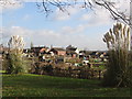
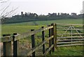
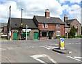
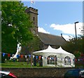
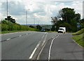
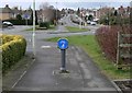
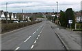
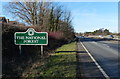
39 photos from this area
Area Information
Key information about the LE6 0FN including its size, population, and administrative classification.
- Area Type
- Postcode
- Area Size
- 4551 m²
- Population
- 1573
- Population Density
- 247 people/km²
House Prices in LE6 0FN
20
Properties
£153,827
Average Sold Price
£48,500
Lowest Price
£272,000
Highest Price
Showing 20 properties
| Address | Type | Beds | Baths | Last Sale Price | Last Sale Date | |
|---|---|---|---|---|---|---|
| 5 Fir Tree Walk, Groby, LE6 0FN | Terraced | 3 | 1 | £140,000 | Jun 2025 | |
| 2 Fir Tree Walk, Groby, LE6 0FN | house | 3 | 1 | £272,000 | Mar 2025 | |
| 15 Fir Tree Walk, Groby, LE6 0FN | Terraced | 3 | 1 | £206,000 | Mar 2025 | |
| 14 Fir Tree Walk, Groby, LE6 0FN | Semi-detached | 3 | 1 | £205,000 | Jun 2024 | |
| 3 Fir Tree Walk, Groby, LE6 0FN | Terraced | 3 | 1 | £219,000 | Mar 2024 | |
| 8 Fir Tree Walk, Groby, LE6 0FN | Semi-detached | 3 | 1 | £235,000 | Jun 2023 | |
| 1 Fir Tree Walk, Groby, LE6 0FN | Semi-detached | 3 | 1 | £184,950 | Feb 2019 | |
| 18 Fir Tree Walk, Groby, LE6 0FN | Terraced | 3 | - | £144,000 | Oct 2015 | |
| 16 Fir Tree Walk, Groby, LE6 0FN | house | - | - | £61,625 | Jan 2014 | |
| 24 Fir Tree Walk, Groby, LE6 0FN | Terraced | - | - | £157,000 | Aug 2007 |
Page 1 of 2
Energy Efficiency in LE6 0FN
Amenities
Schools
| Rank | School | Type | Entry gender | Ages |
|---|
Explore more schools in this area
Go to Schools tabDemographics
Household Size
Two person
most common
Accommodation Type
Houses
most common
Tenure
73
majority
Ethnic Group
White
most common
Religion
N/A
most common
Household Composition
N/A
most common
Age
47
median
Adults (30-64 years)
most common
Household Deprivation
N/A
with no deprivation
NS-SEC
32
in Lower managerial occupations
Explore more demographic insights in this area
Go to Demographics tabPlanning
Planning Constraints
- Flood RiskPremium
- Ramsar Wetland SitesPremium
- Area of Outstanding Natural BeautyPremium
- Protected Nature ReservePremium
- Protected WoodlandPremium