Area Overview for LE55 8RX
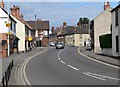
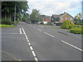
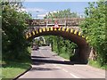
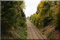
Photos of LE55 8RX

Area Information
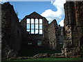
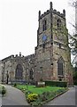
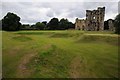
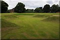
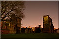
Living in LE55 8RX means being part of a small, tightly knit residential cluster in England’s East Midlands. With a population of 1,904 and a density of 1,350 people per square kilometre, this postcode area is compact yet functional, blending modern living with historical roots. The nearby town of Ashby de la Zouch, with its medieval castle and Anglo-Danish heritage, adds a layer of quiet charm to the region. Daily life here is shaped by its proximity to local amenities, schools, and a modest network of retail outlets. The area is not sprawling but carefully planned, offering a sense of community without the congestion of larger towns. Residents benefit from a stable housing stock, predominantly owner-occupied homes, and a median age of 47, suggesting a mature, established population. While the postcode itself is small, it sits within a broader landscape of rolling countryside and historic sites, providing a balance between convenience and tranquillity for those seeking a grounded, low-maintenance lifestyle.
- Area Type
- Postcode
- Area Size
- Not available
- Population
- 1904
- Population Density
- 1350 people/km²
The property market in LE55 8RX is dominated by owner-occupied homes, with 69% of residents owning their properties. This high rate of home ownership indicates a stable, long-term community with limited rental activity. The accommodation type is primarily houses, which suggests a focus on family-friendly, spacious living rather than apartments or terraced housing. As a small postcode area, the housing stock is likely limited, making it a niche market for buyers seeking established homes in a quiet setting. The lack of flats or newer developments may appeal to those prioritising traditional architecture and privacy. However, the limited size of the area means that property availability could be constrained, requiring buyers to consider nearby suburbs or towns for more options. The market is likely to be competitive, with properties retaining value due to the area’s low crime risk and proximity to amenities.
House Prices in LE55 8RX
No properties found in this postcode.
Energy Efficiency in LE55 8RX
The lifestyle in LE55 8RX is shaped by its proximity to a range of local amenities, including five retail outlets such as Aldi Ashby-de-la, M&S Ashby-de-la, and Asda Ashby. These shops provide essential services and convenience, reducing the need for long trips to larger towns. While the area lacks detailed information on dining or leisure facilities, the presence of major supermarkets suggests a focus on practicality and accessibility. The small scale of the postcode means that amenities are likely concentrated within walking or short driving distance, enhancing daily convenience. For residents, this balance of retail options and a compact layout fosters a self-contained lifestyle, ideal for those prioritising ease of access over extensive leisure choices.
Amenities
Schools
Nearby LE55 8RX, Ashby School serves as a key educational institution, operating as both a primary school and an academy. A second academy, also named Ashby School, shares the same location and holds a ‘good’ Ofsted rating, indicating a reliable standard of education. The presence of two schools under the same name may suggest a consolidated or multi-phase educational offering, potentially catering to different age groups or specialisms. For families, this combination of primary and academy schooling provides a range of options, though the absence of additional schools or nurseries might limit choices for younger children or those seeking specialist provision. The ‘good’ rating at the academy is a positive sign, suggesting that students receive a solid education, though parents may need to look further afield for broader school diversity.
| Rank | School | Type | Entry gender | Ages |
|---|---|---|---|---|
| 1 | Ashby School | primary | N/A | N/A |
| 2 | Ashby School | academy | N/A | N/A |
| 3 | Ashby School | academy | N/A | N/A |
Explore more schools in this area
Go to Schools tabDemographics
The community in LE55 8RX is predominantly composed of adults aged 30–64, with a median age of 47. This suggests a mature, settled population, likely focused on family life or retirement. Home ownership is high at 69%, with the majority of properties being houses rather than flats, reflecting a preference for traditional, spacious living. The predominant ethnic group is White, indicating a relatively homogenous demographic. While no specific data on deprivation is provided, the high home ownership rate and age profile suggest a stable economic environment. The absence of younger families or students may mean fewer schools or childcare facilities, though the area does have a mix of primary and academy schools. The community’s character is defined by its older residents, many of whom may have lived in the area for decades, contributing to a sense of continuity and familiarity.
Household Size
Accommodation Type
Tenure
Ethnic Group
Religion
Household Composition
Age
Household Deprivation
NS-SEC
Explore more demographic insights in this area
Go to Demographics tabPlanning
Planning Constraints
- Flood RiskPremium
- Ramsar Wetland SitesPremium
- Area of Outstanding Natural BeautyPremium
- Protected Nature ReservePremium
- Protected WoodlandPremium
- Crime RiskPremium