Area Overview for LE5 6FH
Photos of LE5 6FH
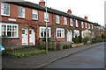
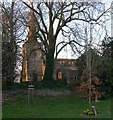
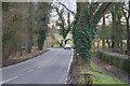
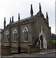
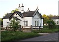
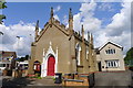
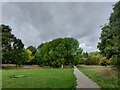
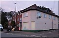
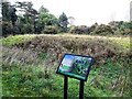
61 photos from this area
Area Information
Key information about the LE5 6FH including its size, population, and administrative classification.
- Area Type
- Postcode
- Area Size
- 4.6 hectares
- Population
- 1994
- Population Density
- 1453 people/km²
House Prices in LE5 6FH
18
Properties
£222,999
Average Sold Price
£124,995
Lowest Price
£425,000
Highest Price
Showing 18 properties
| Address | Type | Beds | Baths | Last Sale Price | Last Sale Date | |
|---|---|---|---|---|---|---|
| 5 High Street, Evington, Leicester, LE5 6FH | Cottage | 2 | 1 | £195,000 | Jan 2025 | |
| 3 High Street, Evington, Leicester, LE5 6FH | house | - | - | £124,995 | Dec 2016 | |
| Arbor House, High Street, Evington, Leicester, LE5 6FH | hospital_care_home | - | - | £425,000 | Oct 2015 | |
| 1 High Street, Evington, Leicester, LE5 6FH | house | 2 | 1 | £147,000 | Oct 2012 | |
| 19 High Street, Evington, Leicester, LE5 6FH | Cottage | 2 | - | - | - | |
| Flat 1, 9 High Street, Evington, Leicester, LE5 6FH | Flat | - | - | - | - | |
| Flat 2, 9 High Street, Evington, Leicester, LE5 6FH | Flat | - | - | - | - | |
| Flat 4, 9 High Street, Evington, Leicester, LE5 6FH | Flat | - | - | - | - | |
| Flat 11, 13 High Street, Evington, Leicester, LE5 6FH | Flat | - | - | - | - | |
| Flat 9, 13 High Street, Evington, Leicester, LE5 6FH | Flat | - | - | - | - |
Page 1 of 2
Energy Efficiency in LE5 6FH
Amenities
Schools
| Rank | School | Type | Entry gender | Ages |
|---|
Explore more schools in this area
Go to Schools tabDemographics
Household Size
Family (3-5 people)
most common
Accommodation Type
Houses
most common
Tenure
73
majority
Ethnic Group
asian_total
most common
Religion
N/A
most common
Household Composition
N/A
most common
Age
47
median
Adults (30-64 years)
most common
Household Deprivation
N/A
with no deprivation
NS-SEC
33
in Lower managerial occupations
Explore more demographic insights in this area
Go to Demographics tabPlanning
Planning Constraints
- Flood RiskPremium
- Ramsar Wetland SitesPremium
- Area of Outstanding Natural BeautyPremium
- Protected Nature ReservePremium
- Protected WoodlandPremium