Area Overview for LE5 5NW
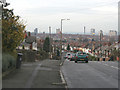
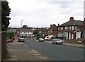
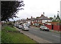
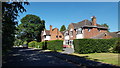
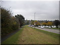
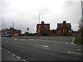
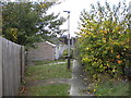
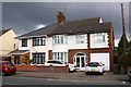
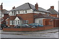
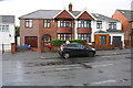
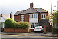
Photos of LE5 5NW

Area Information
Living in LE5 5NW offers a compact, residential experience shaped by its small cluster of homes and proximity to key infrastructure. With a population of 1,644, the area is tightly knit, ideal for those seeking a quieter, community-focused lifestyle. The postcode covers a defined residential zone, where the majority of residents are adults aged 30–64, reflecting a mature, stable demographic. Daily life here is characterised by easy access to nearby amenities, including three rail stations—Leicester, South Wigston, and Syston—which connect residents to broader regional networks. The area’s broadband score of 100 ensures seamless digital connectivity, while mobile coverage of 85 supports reliable communication. LE5 5NW is a practical choice for buyers prioritising convenience, with shops like Tesco Leicester and Co-op Evington within reach. Its small size means it’s well-suited to those who value proximity to transport, retail, and services without the bustle of larger urban centres.
- Area Type
- Postcode
- Area Size
- Not available
- Population
- 1644
- Population Density
- 7733 people/km²
The property market in LE5 5NW is dominated by owner-occupied homes, with 77% of residents owning their properties. This high rate of home ownership suggests a stable, long-term market with limited rental activity, making it a less common area for short-term lettings. The accommodation type is primarily houses, which is unusual for smaller postcode areas but may indicate a focus on family homes or larger residences. This housing stock likely appeals to buyers seeking private, spacious living with a sense of permanence. Given the area’s compact size, property values may be influenced by proximity to transport links and retail hubs such as Tesco Leicester and Co-op Evington. Buyers should consider the limited number of properties available, as the small population and residential cluster suggest a niche market with fewer options for those seeking immediate relocation.
House Prices in LE5 5NW
No properties found in this postcode.
Energy Efficiency in LE5 5NW
Life in LE5 5NW is shaped by its proximity to essential amenities. Retail options include major supermarkets such as Tesco Leicester, Co-op Evington, and Morrisons Daily, ensuring easy access to groceries and everyday essentials. The area’s rail network, with stations like Leicester and South Wigston, connects residents to broader urban and regional services, while the nearby Leicester Airport provides direct air travel links. For leisure, the presence of the Great Central Railway and Leicester North metro stations suggests opportunities for weekend excursions or commuting to cultural centres. The area’s compact size means amenities are within practical reach, reducing the need for long commutes. This balance of retail, transport, and connectivity fosters a convenient, self-contained lifestyle where daily needs are met without venturing far from home.
Amenities
Schools
| Rank | School | Type | Entry gender | Ages |
|---|
Explore more schools in this area
Go to Schools tabDemographics
The community in LE5 5NW is predominantly composed of adults aged 30–64, with a median age of 47. This suggests a mature, established population, likely with long-term ties to the area. Home ownership is high at 77%, indicating a stable housing market with a focus on long-term residency rather than rental turnover. The accommodation type is primarily houses, which aligns with the area’s residential character and may appeal to families or individuals seeking private, spacious living. The predominant ethnic group is Asian, reflecting a culturally diverse community. While no specific deprivation data is provided, the high home ownership and age profile suggest a relatively secure, middle-income demographic. This mix of stability and diversity contributes to a cohesive, community-oriented environment where residents are likely to have shared interests and social ties.
Household Size
Accommodation Type
Tenure
Ethnic Group
Religion
Household Composition
Age
Household Deprivation
NS-SEC
Explore more demographic insights in this area
Go to Demographics tabPlanning
Planning Constraints
- Flood RiskPremium
- Ramsar Wetland SitesPremium
- Area of Outstanding Natural BeautyPremium
- Protected Nature ReservePremium
- Protected WoodlandPremium