Area Overview for LE5 5LH
Photos of LE5 5LH
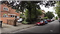
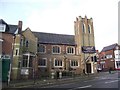
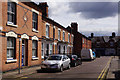


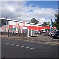
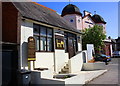
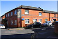
86 photos from this area
Area Information
Key information about the LE5 5LH including its size, population, and administrative classification.
- Area Type
- Postcode
- Area Size
- 1.2 hectares
- Population
- 1666
- Population Density
- 11211 people/km²
House Prices in LE5 5LH
13
Properties
£175,990
Average Sold Price
£66,950
Lowest Price
£290,000
Highest Price
Showing 13 properties
| Address | Type | Beds | Baths | Last Sale Price | Last Sale Date | |
|---|---|---|---|---|---|---|
| 57 Chesterfield Road, Leicester, LE5 5LH | house | - | - | £275,000 | May 2019 | |
| 65 Chesterfield Road, Leicester, LE5 5LH | house | - | - | £153,000 | Nov 2009 | |
| 55 Chesterfield Road, Leicester, LE5 5LH | Semi-detached | - | - | £290,000 | Sep 2007 | |
| 51 Chesterfield Road, Leicester, LE5 5LH | Semi-detached | 5 | 3 | £95,000 | Mar 2002 | |
| 61 Chesterfield Road, Leicester, LE5 5LH | house | - | - | £66,950 | Sep 1999 | |
| 63 Chesterfield Road, Leicester, LE5 5LH | Detached | 5 | 2 | - | - | |
| 47 Chesterfield Road, Leicester, LE5 5LH | house | - | - | - | - | |
| 45 Chesterfield Road, Leicester, LE5 5LH | Semi-detached | - | - | - | - | |
| 49 Chesterfield Road, Leicester, LE5 5LH | house | - | - | - | - | |
| 53 Chesterfield Road, Leicester, LE5 5LH | Semi-detached | - | - | - | - |
Page 1 of 2
Energy Efficiency in LE5 5LH
Amenities
Schools
| Rank | School | Type | Entry gender | Ages |
|---|
Explore more schools in this area
Go to Schools tabDemographics
Household Size
Family (3-5 people)
most common
Accommodation Type
Houses
most common
Tenure
69
majority
Ethnic Group
asian_total
most common
Religion
N/A
most common
Household Composition
N/A
most common
Age
47
median
Adults (30-64 years)
most common
Household Deprivation
N/A
with no deprivation
NS-SEC
19
in Lower managerial occupations
Explore more demographic insights in this area
Go to Demographics tabPlanning
Planning Constraints
- Flood RiskPremium
- Ramsar Wetland SitesPremium
- Area of Outstanding Natural BeautyPremium
- Protected Nature ReservePremium
- Protected WoodlandPremium