Area Overview for LE5 5BP
Photos of LE5 5BP
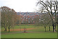
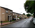
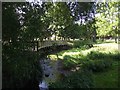
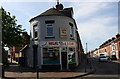
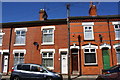
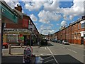
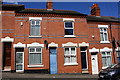
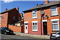
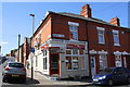
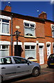
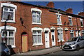
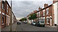
96 photos from this area
Area Information
Key information about the LE5 5BP including its size, population, and administrative classification.
- Area Type
- Postcode
- Area Size
- 3223 m²
- Population
- 1703
- Population Density
- 7411 people/km²
House Prices in LE5 5BP
22
Properties
£155,797
Average Sold Price
£31,000
Lowest Price
£330,000
Highest Price
Showing 22 properties
| Address | Type | Beds | Baths | Last Sale Price | Last Sale Date | |
|---|---|---|---|---|---|---|
| 7 Park Vale Road, Leicester, LE5 5BP | house | - | - | £330,000 | Feb 2024 | |
| 33 Park Vale Road, Leicester, LE5 5BP | Terraced | 3 | 1 | £240,000 | Nov 2023 | |
| 43 Park Vale Road, Leicester, LE5 5BP | house | 3 | 2 | £270,000 | Nov 2022 | |
| 19 Park Vale Road, Leicester, LE5 5BP | house | - | - | £94,250 | Jun 2020 | |
| 25 Park Vale Road, Leicester, LE5 5BP | house | - | - | £227,000 | Feb 2018 | |
| 3 Park Vale Road, Leicester, LE5 5BP | house | - | - | £325,000 | Dec 2015 | |
| 23 Park Vale Road, Leicester, LE5 5BP | house | - | - | £123,000 | Nov 2009 | |
| 5 Park Vale Road, Leicester, LE5 5BP | Terraced | 4 | 2 | £170,000 | Jul 2009 | |
| 11 Park Vale Road, Leicester, LE5 5BP | house | - | - | £146,500 | May 2009 | |
| 13 Park Vale Road, Leicester, LE5 5BP | Terraced | - | - | £180,000 | Dec 2005 |
Page 1 of 3
Energy Efficiency in LE5 5BP
Amenities
Schools
| Rank | School | Type | Entry gender | Ages |
|---|
Explore more schools in this area
Go to Schools tabDemographics
Household Size
Family (3-5 people)
most common
Accommodation Type
Houses
most common
Tenure
54
majority
Ethnic Group
asian_total
most common
Religion
N/A
most common
Household Composition
N/A
most common
Age
47
median
Adults (30-64 years)
most common
Household Deprivation
N/A
with no deprivation
NS-SEC
12
in Lower managerial occupations
Explore more demographic insights in this area
Go to Demographics tabPlanning
Planning Constraints
- Flood RiskPremium
- Ramsar Wetland SitesPremium
- Area of Outstanding Natural BeautyPremium
- Protected Nature ReservePremium
- Protected WoodlandPremium