Area Overview for LE5 4PW
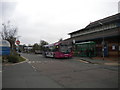
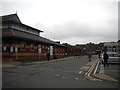
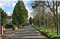
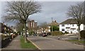
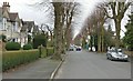
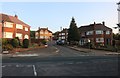
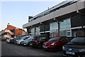
Photos of LE5 4PW

Area Information
Living in LE5 4PW means being part of a tightly packed residential cluster in England, where 1,357 people reside across 11.9 hectares. The area’s high population density of 11,374 people per square kilometre creates a compact, community-focused environment. This postcode is defined by its small-scale character, with homes predominantly in private ownership and a strong presence of the Asian community. Daily life here is shaped by proximity to essential services, including three railway stations and a nearby airport, which offer easy access to Leicester and beyond. The area’s mix of retail options, from supermarkets to local shops, supports a practical lifestyle. While the population skews towards adults aged 30–64, the median age of 47 suggests a stable, established community. LE5 4PW is not a sprawling suburb but a concentrated hub where convenience and connectivity are prioritised, though the small size means limited space for expansion. For buyers, it’s a place where proximity to amenities and transport links outweighs the need for sprawling landscapes.
- Area Type
- Postcode
- Area Size
- 11.9 hectares
- Population
- 1357
- Population Density
- 1823 people/km²
The property market in LE5 4PW is characterised by a high rate of home ownership (64%) and a focus on houses rather than flats or apartments. This suggests a community of long-term residents who value private, family-oriented living spaces. The small area size of 11.9 hectares means the housing stock is limited, which could create competition among buyers and renters. With most properties being houses, the market is less geared towards short-term rentals or student accommodation, making it more attractive to families. However, the compact nature of the area may restrict the availability of larger homes or properties with extensive gardens. Buyers should consider that the high population density and limited land area could impact future property values or development potential. For those seeking a stable, owner-occupied home in a connected location, LE5 4PW offers a focused market, but its size means it is not suited to those needing expansive living spaces.
House Prices in LE5 4PW
Showing 3 properties
| Address | Type | Beds | Baths | Last Sale Price | Last Sale Date | |
|---|---|---|---|---|---|---|
| Wakerley House Younger Disabled Unit, Leicester General Hospital, Gwendolen Road, Leicester, LE5 4PW | commercial | - | - | - | - | |
| Jackson House, Leicester General Hospital, Gwendolen Road, Leicester, LE5 4PW | commercial | - | - | - | - | |
| Residential Rooms In Rmo Corridor, Leicester General Hospital, Gwendolen Road, Leicester, LE5 4PW | commercial | - | - | - | - |
Energy Efficiency in LE5 4PW
Daily life in LE5 4PW is shaped by its proximity to retail hubs, including Tesco Leicester, Morrisons Daily, and Iceland Uppingham, which provide a range of shopping options. The area’s rail network connects residents to Leicester and surrounding towns, while the nearby Leicester Airport offers additional travel routes. For leisure, the presence of three metro stations—Leicester North, Great Central Railway, and Rothley—adds to the transport diversity. The compact nature of the area means amenities are within walking distance, though the lack of named parks or recreational spaces is not specified in the data. The mix of retail and transport options supports a practical lifestyle, with easy access to essentials and travel. However, the absence of detailed information on leisure facilities means residents may need to venture further for larger recreational opportunities. Overall, the area’s convenience is its strongest asset for those prioritising accessibility over expansive green spaces.
Amenities
Schools
Residents of LE5 4PW have access to a range of educational institutions, including Linden Primary School, which holds a ‘good’ Ofsted rating. This primary school provides a solid foundation for younger children, while special schools such as Ash Field School, Leicester Hospital School, and Ash Field Academy cater to students with specific needs. The presence of both mainstream and specialist schools indicates a diverse educational landscape, accommodating families with varying requirements. However, no secondary schools are listed in the data, which may prompt parents to consider nearby areas for comprehensive schooling. The mix of school types ensures that children with additional needs have dedicated support, but families seeking a full range of educational options may need to look beyond LE5 4PW. The quality of primary education at Linden Primary is a notable advantage, though the lack of secondary options is a limitation for those prioritising a single-school catchment.
| Rank | School | Type | Entry gender | Ages |
|---|
Explore more schools in this area
Go to Schools tabDemographics
The community in LE5 4PW is predominantly composed of adults aged 30–64, with a median age of 47. This age range indicates a population largely focused on established careers and family life, rather than younger or retired residents. Home ownership is strong, with 64% of properties owned by residents, suggesting a stable housing market. The area’s accommodation is primarily houses, which aligns with the demographic profile of families requiring more space. The predominant ethnic group is Asian, reflecting a cultural diversity that influences local businesses and social dynamics. The high population density of 11,374 people per square kilometre means residents live closely together, which can foster a sense of community but may also limit private outdoor space. While no deprivation data is provided, the high home ownership rate and presence of essential amenities suggest a relatively secure quality of life. However, the compact nature of the area may challenge those seeking larger homes or more open environments.
Household Size
Accommodation Type
Tenure
Ethnic Group
Religion
Household Composition
Age
Household Deprivation
NS-SEC
Explore more demographic insights in this area
Go to Demographics tabPlanning
Planning Constraints
- Flood RiskPremium
- Ramsar Wetland SitesPremium
- Area of Outstanding Natural BeautyPremium
- Protected Nature ReservePremium
- Protected WoodlandPremium