Area Overview for LE5 3AT
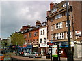
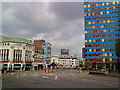
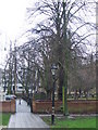
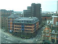
Photos of LE5 3AT


Area Information
Living in LE5 3AT means being part of a small, tightly knit residential cluster in England. With a population of just 1,186, this area is compact yet connected to nearby towns through practical transport links. The community is young, with the majority of residents aged 15–29, reflecting a demographic shaped by students, early-career professionals, and young families. Daily life here is defined by proximity to retail hubs like Lidl Central and Tesco Leicester, as well as frequent rail services from Leicester Railway Station and Syston Railway Station. The area’s small size means neighbours are close, and amenities are within walking or cycling distance. While the housing stock is limited to flats, the area’s appeal lies in its accessibility to larger cities and its balance of affordability with connectivity. For those seeking a base near transport networks and essential services, LE5 3AT offers a pragmatic, if modest, lifestyle.
- Area Type
- Postcode
- Area Size
- Not available
- Population
- 1186
- Population Density
- 9642 people/km²
The property market in LE5 3AT is characterised by a high proportion of rental flats, with only 10% of homes owned by residents. This suggests a market dominated by landlords and tenants rather than owner-occupiers. The area’s small size and limited housing stock mean there are few opportunities for buyers seeking a long-term home. Flats are the primary accommodation type, which may appeal to those prioritising affordability and proximity to transport. However, the low home ownership rate indicates limited demand for owner-occupied properties, potentially affecting property value growth. For buyers, this area is more suited to investment or short-term rental strategies than to purchasing a family home. The compact nature of the postcode also means the surrounding areas may hold more varied housing options.
House Prices in LE5 3AT
No properties found in this postcode.
Energy Efficiency in LE5 3AT
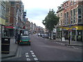
Life in LE5 3AT is shaped by its proximity to retail and transport hubs. Within walking distance are supermarkets like Lidl Central, Tesco Leicester, and Tesco Haymarket, offering everyday shopping convenience. The area’s rail links to Leicester Railway Station and Syston Railway Station provide swift access to city amenities, cultural attractions, and employment centres. Nearby, the Great Central Railway and Rothley metro stations add further connectivity. While the area itself is small, its integration with larger towns means residents have access to a broader range of leisure and dining options. The practical reach of amenities ensures daily needs are met without long commutes, though the community’s character is defined by its role as a transit-oriented suburb rather than a standalone destination.
Amenities
Schools
| Rank | School | Type | Entry gender | Ages |
|---|
Explore more schools in this area
Go to Schools tabDemographics
The population of LE5 3AT is overwhelmingly young, with a median age of 22 and 80% of residents falling within the 15–29 age range. This reflects a community dominated by students, recent graduates, and young professionals. Home ownership is exceptionally low at 10%, meaning most residents rent their flats, which are the predominant type of accommodation. The area’s demographic profile suggests a transient population, with limited long-term residency. The predominant ethnic group is White, though no specific diversity metrics are provided. The low home ownership rate and youth-centric profile indicate a rental market skewed towards short-term tenancies, which may affect community stability. For buyers, this suggests a focus on investment properties rather than owner-occupied homes.
Household Size
Accommodation Type
Tenure
Ethnic Group
Religion
Household Composition
Age
Household Deprivation
NS-SEC
Explore more demographic insights in this area
Go to Demographics tabPlanning
Planning Constraints
- Flood RiskPremium
- Ramsar Wetland SitesPremium
- Area of Outstanding Natural BeautyPremium
- Protected Nature ReservePremium
- Protected WoodlandPremium