Area Overview for LE5 3AF
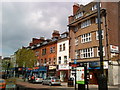
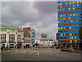
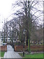
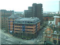
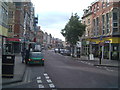
Photos of LE5 3AF


Area Information
Living in LE5 3AF means being part of a small, tightly knit residential cluster in England, home to 1,844 people. This area is defined by its compact size and proximity to essential services, making it practical for daily life. The community is predominantly composed of adults aged 30–64, reflecting a mature demographic with established routines. While the area lacks expansive green spaces or major landmarks, its appeal lies in its accessibility. Residents benefit from nearby rail networks, including Leicester and South Wigston stations, which connect to broader regional routes. The presence of both state and independent schools ensures options for families, while retail outlets like Iceland Leicester and Lidl Central cater to everyday needs. Despite its small footprint, LE5 3AF balances practicality with a functional layout, though its character is shaped by the housing stock—primarily flats—suggesting a mix of renters and long-term residents. The area’s compact nature means amenities are within walking or short driving distance, though its limited size may restrict expansion or new development.
- Area Type
- Postcode
- Area Size
- Not available
- Population
- 1844
- Population Density
- 4622 people/km²
The property market in LE5 3AF is characterised by a high proportion of flats, with home ownership standing at just 22%. This suggests the area is not primarily an owner-occupied market but rather one dominated by rental properties. The focus on flats may appeal to those seeking manageable, low-maintenance housing, though it limits options for buyers seeking larger homes or family-friendly layouts. Given the area’s small size, the immediate surroundings likely offer similar housing stock, reinforcing the prevalence of rental units. For buyers, this means competition for owner-occupied properties may be limited, and the market could be more attractive to investors or those prioritising affordability over property type. The compact nature of LE5 3AF also means that housing choices are constrained, with little scope for new developments or varied property styles.
House Prices in LE5 3AF
No properties found in this postcode.
Energy Efficiency in LE5 3AF
The lifestyle in LE5 3AF is shaped by its proximity to essential amenities. Retail options include Iceland Leicester, Aldi Spinney, and Lidl Central, offering convenience for daily shopping. The rail network, with stations like Leicester and South Wigston, provides easy access to urban centres and beyond. The Leicester Airport, though not a major hub, adds to the area’s connectivity. For leisure, the mix of retail and transport links supports a practical, low-effort lifestyle. While the area lacks large parks or recreational spaces, its compact design ensures amenities are within reach. The presence of both independent and state schools also contributes to a family-friendly environment, though the limited size of LE5 3AF means opportunities for expansion or new facilities are constrained.
Amenities
Schools
Residents of LE5 3AF have access to a range of schools, including Charnwood Primary School, a state primary institution, and Moat Community College, which also operates at the primary level and holds a ‘good’ Ofsted rating. For independent education, Leicester International School and Islamic Dawah Academy cater to specific needs, while The Mulberry School provides special education services. This mix of state and independent options offers flexibility for families, whether they prioritise local public schools or seek alternative curricula. The presence of both mainstream and specialist institutions ensures coverage for diverse educational requirements, though the area’s small size means school catchment areas are likely tightly defined. Parents should consider proximity to specific schools when evaluating properties, as transport links may influence daily commutes for students.
| Rank | School | Type | Entry gender | Ages |
|---|
Explore more schools in this area
Go to Schools tabDemographics
The population of LE5 3AF is 1,844, with a median age of 47, indicating a community skewed toward middle-aged adults. The most common age range is 30–64, suggesting a stable, established demographic. Home ownership is low at 22%, meaning most residents are likely renters, which may reflect the area’s focus on flats as the primary accommodation type. The predominant ethnic group is Asian, highlighting cultural diversity within the community. This demographic profile implies a population with established careers and family structures, though the low home ownership rate may indicate limited opportunities for property investment or long-term residency. The absence of specific deprivation data means quality of life factors like income levels or access to services remain unquantified, but the presence of multiple schools and transport links suggests a baseline of accessibility.
Household Size
Accommodation Type
Tenure
Ethnic Group
Religion
Household Composition
Age
Household Deprivation
NS-SEC
Explore more demographic insights in this area
Go to Demographics tabPlanning
Planning Constraints
- Flood RiskPremium
- Ramsar Wetland SitesPremium
- Area of Outstanding Natural BeautyPremium
- Protected Nature ReservePremium
- Protected WoodlandPremium