Area Overview for LE5 2QE
Photos of LE5 2QE
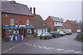
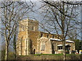
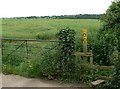
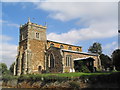
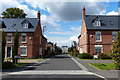
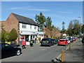
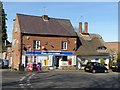
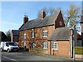
67 photos from this area
Area Information
Key information about the LE5 2QE including its size, population, and administrative classification.
- Area Type
- Postcode
- Area Size
- 3962 m²
- Population
- 1567
- Population Density
- 8069 people/km²
House Prices in LE5 2QE
16
Properties
£160,025
Average Sold Price
£73,250
Lowest Price
£252,000
Highest Price
Showing 16 properties
| Address | Type | Beds | Baths | Last Sale Price | Last Sale Date | |
|---|---|---|---|---|---|---|
| 91 Kirkwall Crescent, Leicester, LE5 2QE | Terraced | 3 | 1 | £228,000 | Oct 2023 | |
| 89 Kirkwall Crescent, Leicester, LE5 2QE | Terraced | 3 | 1 | £230,000 | Jun 2023 | |
| 113 Kirkwall Crescent, Leicester, LE5 2QE | Semi-detached | 3 | 1 | £252,000 | Mar 2023 | |
| 115 Kirkwall Crescent, Leicester, LE5 2QE | Retail | 3 | 1 | £227,000 | Nov 2022 | |
| 87 Kirkwall Crescent, Leicester, LE5 2QE | Semi-detached | 3 | 1 | £165,000 | Oct 2017 | |
| 105 Kirkwall Crescent, Leicester, LE5 2QE | Semi-detached | 3 | - | £121,000 | May 2016 | |
| 107 Kirkwall Crescent, Leicester, LE5 2QE | Semi-detached | 3 | - | £92,000 | Oct 2013 | |
| 85 Kirkwall Crescent, Leicester, LE5 2QE | house | - | - | £115,000 | Jan 2007 | |
| 97 Kirkwall Crescent, Leicester, LE5 2QE | Terraced | - | - | £97,000 | Feb 2005 | |
| 99 Kirkwall Crescent, Leicester, LE5 2QE | Terraced | 3 | 1 | £73,250 | Feb 2004 |
Page 1 of 2
Energy Efficiency in LE5 2QE
Amenities
Schools
| Rank | School | Type | Entry gender | Ages |
|---|
Explore more schools in this area
Go to Schools tabDemographics
Household Size
One person
most common
Accommodation Type
Houses
most common
Tenure
38
majority
Ethnic Group
White
most common
Religion
N/A
most common
Household Composition
N/A
most common
Age
47
median
Adults (30-64 years)
most common
Household Deprivation
N/A
with no deprivation
NS-SEC
15
in Lower managerial occupations
Explore more demographic insights in this area
Go to Demographics tabPlanning
Planning Constraints
- Flood RiskPremium
- Ramsar Wetland SitesPremium
- Area of Outstanding Natural BeautyPremium
- Protected Nature ReservePremium
- Protected WoodlandPremium