Area Overview for LE5 2NL
Photos of LE5 2NL
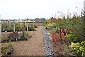
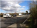
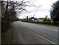
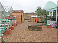

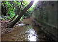
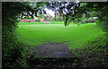
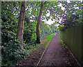
45 photos from this area
Area Information
Key information about the LE5 2NL including its size, population, and administrative classification.
- Area Type
- Postcode
- Area Size
- 1.6 hectares
- Population
- 1677
- Population Density
- 8831 people/km²
House Prices in LE5 2NL
23
Properties
£147,045
Average Sold Price
£71,000
Lowest Price
£275,000
Highest Price
Showing 23 properties
| Address | Type | Beds | Baths | Last Sale Price | Last Sale Date | |
|---|---|---|---|---|---|---|
| 213 Thurncourt Road, Leicester, LE5 2NL | Terraced | 3 | 1 | £275,000 | Sep 2025 | |
| 235 Thurncourt Road, Leicester, LE5 2NL | house | - | - | £155,000 | Apr 2025 | |
| 207 Thurncourt Road, Leicester, LE5 2NL | Semi-detached | 2 | 1 | £230,000 | Nov 2023 | |
| 243 Thurncourt Road, Leicester, LE5 2NL | Retail | 2 | 1 | £235,000 | Mar 2022 | |
| 241 Thurncourt Road, Leicester, LE5 2NL | Semi-detached | 2 | 1 | £210,000 | Aug 2020 | |
| 233 Thurncourt Road, Leicester, LE5 2NL | house | 3 | 1 | £88,000 | Aug 2013 | |
| 237 Thurncourt Road, Leicester, LE5 2NL | house | - | - | £80,000 | Mar 2008 | |
| 205 Thurncourt Road, Leicester, LE5 2NL | Detached | 2 | 1 | £95,500 | Nov 2006 | |
| 239 Thurncourt Road, Leicester, LE5 2NL | house | - | - | £86,000 | Feb 2006 | |
| 209 Thurncourt Road, Leicester, LE5 2NL | Terraced | 2 | 1 | £92,000 | Dec 2005 |
Page 1 of 3
Energy Efficiency in LE5 2NL
Amenities
Schools
| Rank | School | Type | Entry gender | Ages |
|---|
Explore more schools in this area
Go to Schools tabDemographics
Household Size
Family (3-5 people)
most common
Accommodation Type
Houses
most common
Tenure
54
majority
Ethnic Group
White
most common
Religion
N/A
most common
Household Composition
N/A
most common
Age
47
median
Adults (30-64 years)
most common
Household Deprivation
N/A
with no deprivation
NS-SEC
16
in Lower managerial occupations
Explore more demographic insights in this area
Go to Demographics tabPlanning
Planning Constraints
- Flood RiskPremium
- Ramsar Wetland SitesPremium
- Area of Outstanding Natural BeautyPremium
- Protected Nature ReservePremium
- Protected WoodlandPremium