Area Overview for LE5 2LQ
Photos of LE5 2LQ
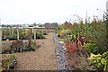
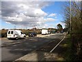
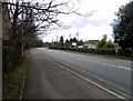
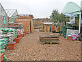

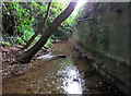
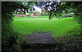
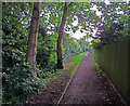
45 photos from this area
Area Information
Key information about the LE5 2LQ including its size, population, and administrative classification.
- Area Type
- Postcode
- Area Size
- 7041 m²
- Population
- 1677
- Population Density
- 8831 people/km²
House Prices in LE5 2LQ
25
Properties
£97,632
Average Sold Price
£26,950
Lowest Price
£160,000
Highest Price
Showing 25 properties
| Address | Type | Beds | Baths | Last Sale Price | Last Sale Date | |
|---|---|---|---|---|---|---|
| 43 Kinross Avenue, Leicester, LE5 2LQ | house | - | - | £147,500 | Sep 2021 | |
| 31 Kinross Avenue, Leicester, LE5 2LQ | house | - | - | £160,000 | May 2020 | |
| 16 Kinross Avenue, Leicester, LE5 2LQ | Semi-detached | 3 | 1 | £142,500 | Dec 2017 | |
| 26 Kinross Avenue, Leicester, LE5 2LQ | house | - | - | £126,000 | Sep 2017 | |
| 35 Kinross Avenue, Leicester, LE5 2LQ | Terraced | 2 | 1 | £95,000 | Oct 2016 | |
| 33 Kinross Avenue, Leicester, LE5 2LQ | house | 3 | 1 | £107,000 | Mar 2015 | |
| 24 Kinross Avenue, Leicester, LE5 2LQ | Terraced | 3 | 1 | £99,000 | Feb 2014 | |
| 39 Kinross Avenue, Leicester, LE5 2LQ | house | - | - | £103,000 | Mar 2008 | |
| 20 Kinross Avenue, Leicester, LE5 2LQ | Terraced | 3 | 1 | £38,000 | Jan 2004 | |
| 37 Kinross Avenue, Leicester, LE5 2LQ | house | - | - | £26,950 | Jul 1998 |
Page 1 of 3
Energy Efficiency in LE5 2LQ
Amenities
Schools
| Rank | School | Type | Entry gender | Ages |
|---|
Explore more schools in this area
Go to Schools tabDemographics
Household Size
Family (3-5 people)
most common
Accommodation Type
Houses
most common
Tenure
54
majority
Ethnic Group
White
most common
Religion
N/A
most common
Household Composition
N/A
most common
Age
47
median
Adults (30-64 years)
most common
Household Deprivation
N/A
with no deprivation
NS-SEC
16
in Lower managerial occupations
Explore more demographic insights in this area
Go to Demographics tabPlanning
Planning Constraints
- Flood RiskPremium
- Ramsar Wetland SitesPremium
- Area of Outstanding Natural BeautyPremium
- Protected Nature ReservePremium
- Protected WoodlandPremium