Area Overview for LE5 2DP
Photos of LE5 2DP
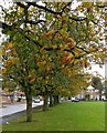
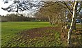
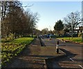
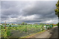
24 photos from this area
Area Information
Key information about the LE5 2DP including its size, population, and administrative classification.
- Area Type
- Postcode
- Area Size
- 3.7 hectares
- Population
- 1453
- Population Density
- 5070 people/km²
House Prices in LE5 2DP
40
Properties
£297,377
Average Sold Price
£60,000
Lowest Price
£625,000
Highest Price
Showing 40 properties
| Address | Type | Beds | Baths | Last Sale Price | Last Sale Date | |
|---|---|---|---|---|---|---|
| 410 Uppingham Road, Leicester, LE5 2DP | house | - | - | £495,000 | Mar 2021 | |
| 418 Uppingham Road, Leicester, LE5 2DP | Detached | 5 | 2 | £625,000 | Nov 2020 | |
| 406 Uppingham Road, Leicester, LE5 2DP | Detached | 4 | 1 | £427,000 | Jul 2020 | |
| 384 Uppingham Road, Leicester, LE5 2DP | Semi-detached | 3 | 2 | £278,000 | Jul 2019 | |
| 376 Uppingham Road, Leicester, LE5 2DP | Detached | 5 | 1 | £352,500 | May 2017 | |
| 438 Uppingham Road, Leicester, LE5 2DP | Detached | 5 | 2 | £380,000 | Dec 2016 | |
| 412 Uppingham Road, Leicester, LE5 2DP | Detached | 5 | 2 | £384,000 | Mar 2016 | |
| 436 Uppingham Road, Leicester, LE5 2DP | Semi-detached | 6 | 4 | £470,000 | Aug 2015 | |
| 414 Uppingham Road, Leicester, LE5 2DP | Detached | 5 | 2 | £425,000 | Apr 2015 | |
| 442 Uppingham Road, Leicester, LE5 2DP | Detached | 3 | - | £290,000 | Oct 2014 |
Page 1 of 4
Energy Efficiency in LE5 2DP
Amenities
Schools
| Rank | School | Type | Entry gender | Ages |
|---|
Explore more schools in this area
Go to Schools tabDemographics
Household Size
Family (3-5 people)
most common
Accommodation Type
Houses
most common
Tenure
61
majority
Ethnic Group
White
most common
Religion
N/A
most common
Household Composition
N/A
most common
Age
47
median
Adults (30-64 years)
most common
Household Deprivation
N/A
with no deprivation
NS-SEC
20
in Lower managerial occupations
Explore more demographic insights in this area
Go to Demographics tabPlanning
Planning Constraints
- Flood RiskPremium
- Ramsar Wetland SitesPremium
- Area of Outstanding Natural BeautyPremium
- Protected Nature ReservePremium
- Protected WoodlandPremium