Area Overview for LE5 1JH
Photos of LE5 1JH
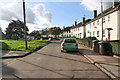
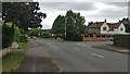
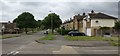
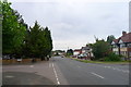
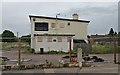
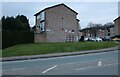
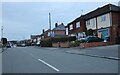
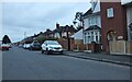
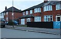
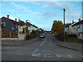
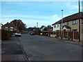
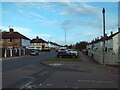
19 photos from this area
Area Information
Key information about the LE5 1JH including its size, population, and administrative classification.
- Area Type
- Postcode
- Area Size
- 8800 m²
- Population
- 1615
- Population Density
- 5480 people/km²
House Prices in LE5 1JH
20
Properties
£173,567
Average Sold Price
£42,000
Lowest Price
£360,000
Highest Price
Showing 20 properties
| Address | Type | Beds | Baths | Last Sale Price | Last Sale Date | |
|---|---|---|---|---|---|---|
| 29 Wigley Road, Leicester, LE5 1JH | house | - | - | £360,000 | Oct 2024 | |
| 41 Wigley Road, Leicester, LE5 1JH | Semi-detached | 2 | 1 | £243,000 | Oct 2023 | |
| 28 Wigley Road, Leicester, LE5 1JH | house | - | - | £225,000 | Aug 2021 | |
| 31 Wigley Road, Leicester, LE5 1JH | Semi-detached | 3 | 1 | £256,000 | Nov 2019 | |
| 27 Wigley Road, Leicester, LE5 1JH | Semi-detached | 3 | - | £167,000 | Nov 2015 | |
| 21 Wigley Road, Leicester, LE5 1JH | Semi-detached | 3 | - | £180,000 | Oct 2015 | |
| 39 Wigley Road, Leicester, LE5 1JH | Semi-detached | 3 | - | £175,000 | Oct 2014 | |
| 23 Wigley Road, Leicester, LE5 1JH | Semi-detached | 3 | - | £170,000 | Jul 2014 | |
| 25 Wigley Road, Leicester, LE5 1JH | house | 3 | 1 | £134,000 | Jun 2012 | |
| 24 Wigley Road, Leicester, LE5 1JH | house | - | - | £150,000 | Oct 2009 |
Page 1 of 2
Energy Efficiency in LE5 1JH
Amenities
Schools
| Rank | School | Type | Entry gender | Ages |
|---|
Explore more schools in this area
Go to Schools tabDemographics
Household Size
Family (3-5 people)
most common
Accommodation Type
Houses
most common
Tenure
69
majority
Ethnic Group
White
most common
Religion
N/A
most common
Household Composition
N/A
most common
Age
47
median
Adults (30-64 years)
most common
Household Deprivation
N/A
with no deprivation
NS-SEC
23
in Lower managerial occupations
Explore more demographic insights in this area
Go to Demographics tabPlanning
Planning Constraints
- Flood RiskPremium
- Ramsar Wetland SitesPremium
- Area of Outstanding Natural BeautyPremium
- Protected Nature ReservePremium
- Protected WoodlandPremium