Area Overview for LE5 1AL
Photos of LE5 1AL
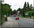
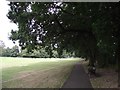
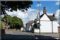
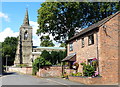
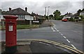
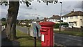
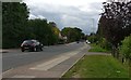
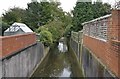
34 photos from this area
Area Information
Key information about the LE5 1AL including its size, population, and administrative classification.
- Area Type
- Postcode
- Area Size
- 2.5 hectares
- Population
- 2005
- Population Density
- 4479 people/km²
House Prices in LE5 1AL
41
Properties
£229,054
Average Sold Price
£74,950
Lowest Price
£520,000
Highest Price
Showing 41 properties
| Address | Type | Beds | Baths | Last Sale Price | Last Sale Date | |
|---|---|---|---|---|---|---|
| 63 Pine Tree Avenue, Leicester, LE5 1AL | Detached | 3 | 1 | £330,000 | Oct 2025 | |
| 41 Pine Tree Avenue, Leicester, LE5 1AL | house | 3 | - | £250,000 | Jun 2023 | |
| 5 Pine Tree Avenue, Leicester, LE5 1AL | Detached | 6 | 2 | £520,000 | Oct 2022 | |
| 51 Pine Tree Avenue, Leicester, LE5 1AL | house | 4 | - | £410,000 | Feb 2021 | |
| 25 Pine Tree Avenue, Leicester, LE5 1AL | house | - | - | £442,500 | Jul 2020 | |
| 75 Pine Tree Avenue, Leicester, LE5 1AL | Bungalow | 3 | 1 | £230,000 | Aug 2018 | |
| 55 Pine Tree Avenue, Leicester, LE5 1AL | Semi-detached | 3 | 1 | £240,000 | Jun 2018 | |
| 37 Pine Tree Avenue, Leicester, LE5 1AL | house | 3 | - | £265,000 | Feb 2017 | |
| 71 Pine Tree Avenue, Leicester, LE5 1AL | Bungalow | - | - | £205,000 | Dec 2016 | |
| 53 Pine Tree Avenue, Leicester, LE5 1AL | Semi-detached | 3 | 1 | £220,000 | Nov 2016 |
Page 1 of 5
Energy Efficiency in LE5 1AL
Amenities
Schools
| Rank | School | Type | Entry gender | Ages |
|---|
Explore more schools in this area
Go to Schools tabDemographics
Household Size
Family (3-5 people)
most common
Accommodation Type
Houses
most common
Tenure
65
majority
Ethnic Group
asian_total
most common
Religion
N/A
most common
Household Composition
N/A
most common
Age
47
median
Adults (30-64 years)
most common
Household Deprivation
N/A
with no deprivation
NS-SEC
27
in Lower managerial occupations
Explore more demographic insights in this area
Go to Demographics tabPlanning
Planning Constraints
- Flood RiskPremium
- Ramsar Wetland SitesPremium
- Area of Outstanding Natural BeautyPremium
- Protected Nature ReservePremium
- Protected WoodlandPremium