Area Overview for LE5 0SB
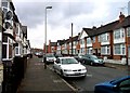
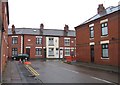
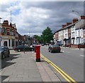
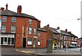
Photos of LE5 0SB


Area Information
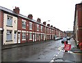
Living in LE5 0SB means being part of a small, tightly knit residential cluster in England with a population of 2,654. The area is characterised by its compact size and focus on single-family homes, which dominate the housing stock. With a median age of 47, the community is primarily composed of adults aged 30 to 64, suggesting a stable, established population. The area’s safety is a key feature, with a crime risk score of 69, placing it below average for the region. Residents benefit from excellent digital connectivity, with a broadband score of 100 — the highest possible — ensuring seamless internet access for work or leisure. While the area lacks major natural or protected landscapes, its proximity to rail networks and retail hubs like Iceland Leicester and Aldi Spinney provides practical convenience. LE5 0SB is ideal for those seeking a quiet, family-oriented environment with reliable infrastructure and minimal environmental constraints.
- Area Type
- Postcode
- Area Size
- Not available
- Population
- 2654
- Population Density
- 11232 people/km²
The property market in LE5 0SB is defined by its low home ownership rate of 27%, indicating that the majority of housing is rented rather than owned. The area is primarily composed of single-family homes, which are more common than apartments or flats. This suggests a market geared towards families or individuals seeking private, detached living spaces. Given the small size of the area, property availability is likely limited, and buyers may need to consider nearby regions for more options. The low home ownership percentage also implies that the local economy may rely on employment opportunities outside the immediate area. For those considering purchasing, the focus on houses means properties are likely to be larger and more spread out than in high-density urban zones. The market’s character is one of quiet stability, with minimal pressure from speculative investment or rapid development.
House Prices in LE5 0SB
No properties found in this postcode.
Energy Efficiency in LE5 0SB
The lifestyle in LE5 0SB is shaped by its proximity to retail hubs and transport networks. Nearby shops include Iceland Leicester, Aldi Spinney, and Iceland Uppingham, providing everyday convenience for groceries and household needs. The area’s rail stations and metro links offer easy access to larger towns and cities, while Leicester Airport ensures connectivity beyond the region. Although the area is small, the combination of retail options, public transport, and minimal environmental constraints creates a practical, low-stress environment. The lack of major parks or leisure facilities within the data suggests that residents may need to travel slightly further for recreational activities. Nonetheless, the balance of convenience and accessibility makes LE5 0SB appealing for those prioritising ease of movement and essential services over expansive amenities.
Amenities
Schools
The nearest schools to LE5 0SB are Shenton Primary School, which serves the primary education needs of local children. The absence of secondary schools in the data suggests that families with older children may need to commute to nearby towns for high school education. The presence of a single primary school indicates a focus on early education within the area, though the lack of diversity in school types may limit options for parents seeking a range of educational approaches. With no additional schools listed, the community’s reliance on this one institution highlights the importance of its quality and accessibility. Prospective residents with children should consider the proximity of secondary schools in surrounding areas when evaluating long-term suitability for their family’s needs.
| Rank | School | Type | Entry gender | Ages |
|---|
Explore more schools in this area
Go to Schools tabDemographics
The demographics of LE5 0SB reflect a mature, settled community. The median age of 47 indicates a population largely in their middle years, with the most common age range being adults aged 30 to 64. Home ownership is relatively low at 27%, suggesting a higher proportion of rental properties in the area. The predominant accommodation type is houses, which aligns with the area’s small, residential character. The predominant ethnic group is Asian_total, highlighting the cultural diversity present. While deprivation data is not explicitly provided, the low home ownership rate may imply a mix of long-term residents and those in rental accommodation. This demographic profile suggests a community focused on stability, with a strong presence of working-age adults and a limited need for childcare infrastructure, as no schools for older age groups are listed nearby.
Household Size
Accommodation Type
Tenure
Ethnic Group
Religion
Household Composition
Age
Household Deprivation
NS-SEC
Explore more demographic insights in this area
Go to Demographics tabPlanning
Planning Constraints
- Flood RiskPremium
- Ramsar Wetland SitesPremium
- Area of Outstanding Natural BeautyPremium
- Protected Nature ReservePremium
- Protected WoodlandPremium