Area Overview for LE41 9AJ
Photos of LE41 9AJ
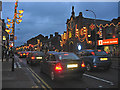
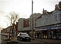
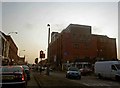
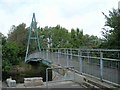



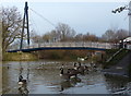
Area Information
Living in LE41 9AJ offers a quiet, residential experience within a small cluster of homes. With a population of 2190, the area is compact yet well-served by nearby amenities. The community is predominantly composed of adults aged 30–64, with a median age of 47, suggesting a stable, established demographic. The area’s housing stock is largely made up of individual homes, reflecting a traditional, low-density layout. While it is not a densely populated region, its proximity to Leicester’s transport networks and retail hubs provides convenience without the bustle of urban centres. Residents benefit from strong digital connectivity, with broadband scores near perfect, ensuring reliable internet for work or leisure. The area’s safety profile shows no significant environmental risks, though crime rates are average, requiring standard precautions. LE41 9AJ is a practical choice for those seeking a balanced lifestyle with access to essential services and a sense of community.
- Area Type
- Postcode
- Area Size
- Not available
- Population
- 2190
- Population Density
- 13281 people/km²
The property market in LE41 9AJ is characterised by a low home ownership rate of 34%, indicating that the majority of homes are rented rather than owned. This suggests a rental-focused market, which may appeal to those seeking flexibility or temporary housing. The accommodation type is primarily houses, which are more common than flats or apartments in this area. This housing stock aligns with the region’s traditional, low-density development pattern. For buyers, the small size of the area means that properties are likely to be limited in number, necessitating a focus on nearby neighbourhoods for more options. The mix of owner-occupied and rental properties may also influence local property values, with potential for growth if demand increases. However, the limited data on property types means that prospective buyers should consider the broader regional market when evaluating investment opportunities.
House Prices in LE41 9AJ
No properties found in this postcode.
Energy Efficiency in LE41 9AJ
Residents of LE41 9AJ have access to a range of amenities within easy reach. Retail options include major supermarkets such as Tesco Leicester, Morrisons Daily, and Lidl Loughborough, ensuring convenience for daily shopping. The area’s transport links, including rail stations and metro services, connect it to broader networks, supporting both local and regional travel. Leicester Airport is also nearby, adding to the area’s accessibility. For leisure, the presence of the Great Central Railway and Rothley metro stations suggests opportunities for travel or commuting to nearby attractions. While the data does not specify parks or recreational spaces, the proximity to rail and retail hubs implies a lifestyle that balances practicality with connectivity. The availability of multiple transport options and retail centres enhances the area’s appeal for those prioritising convenience and accessibility in their daily lives.
Amenities
Schools
The nearest school to LE41 9AJ is Darul Uloom Leicester, an independent institution with a Good Ofsted rating. This school serves as a key educational option for families in the area, offering a structured learning environment. The presence of an independent school suggests that the area may attract households prioritising specific educational philosophies or curricula. However, no other schools are listed in the data, meaning families may need to consider commuting to nearby districts for additional options. The single school’s Good rating indicates it meets national standards, but the lack of diversity in school types could be a consideration for those seeking a broader range of educational choices. For parents, Darul Uloom Leicester provides a reliable option, though proximity to other schools remains a practical concern.
| Rank | School | Type | Entry gender | Ages |
|---|
Explore more schools in this area
Go to Schools tabDemographics
The community in LE41 9AJ is defined by its age profile and cultural makeup. The median age of 47 indicates a mature population, with the majority of residents falling within the 30–64 age range. This suggests a mix of working-age individuals and those nearing retirement. Home ownership is relatively low at 34%, implying that a significant portion of the housing stock is rented out, which could influence the local rental market. The predominant ethnic group is Asian, reflecting the area’s cultural diversity. This demographic profile shapes the area’s character, with a focus on stability and family-oriented living. The absence of specific deprivation data means that quality of life is likely influenced by access to services and infrastructure, which are reasonably strong in this postcode. The community’s composition suggests a need for targeted amenities that cater to both older and middle-aged residents.
Household Size
Accommodation Type
Tenure
Ethnic Group
Religion
Household Composition
Age
Household Deprivation
NS-SEC
Explore more demographic insights in this area
Go to Demographics tabPlanning
Planning Constraints
- Flood RiskPremium
- Ramsar Wetland SitesPremium
- Area of Outstanding Natural BeautyPremium
- Protected Nature ReservePremium
- Protected WoodlandPremium