Area Overview for LE4 8PQ
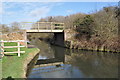
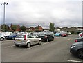
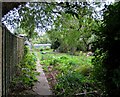
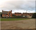
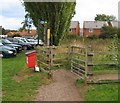
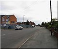
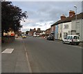
Photos of LE4 8PQ


Area Information
Living in LE4 8PQ means inhabiting a compact, densely populated residential cluster in England. With 1,703 residents spread across a high population density of 1,692 people per square kilometre, this area is characterised by close-knit living. The community is predominantly composed of adults aged 30-64, reflecting a mature demographic profile. Daily life here is shaped by proximity to essential services and transport links. The area’s small size means residents are likely to know their neighbours, though the density also implies a focus on efficient land use. While the postcode covers a limited geographical footprint, it is strategically located near key infrastructure, including retail hubs and rail networks. The absence of environmental constraints like protected woodlands or AONB designations suggests development is unimpeded, though this does not detract from the area’s practical appeal. For those seeking a balance between urban convenience and residential tranquility, LE4 8PQ offers a snapshot of a community where practicality and accessibility are prioritised.
- Area Type
- Postcode
- Area Size
- Not available
- Population
- 1703
- Population Density
- 1692 people/km²
The property market in LE4 8PQ is dominated by owner-occupied homes, with 74% of residents living in properties they own. This high ownership rate suggests a stable, long-term resident base rather than a transient rental market. The accommodation type is predominantly houses, which may indicate a preference for single-family dwellings over flats or apartments. Given the area’s small size and high population density, these homes are likely to be closely spaced, reflecting efficient land use. For buyers, this means a limited inventory of properties, with opportunities focused on existing homes rather than new developments. The absence of planning constraints like protected woodlands or AONB designations may facilitate property modifications or extensions, though this is not explicitly confirmed. Buyers should consider the area’s compact nature, which may limit scope for expansion but ensures proximity to essential services and transport links.
House Prices in LE4 8PQ
No properties found in this postcode.
Energy Efficiency in LE4 8PQ
Residents of LE4 8PQ have access to a range of local amenities within practical reach. Retail options include Spar, Sainsburys Leicester, and Costco Leicester, providing everything from daily essentials to bulk shopping. The area’s rail links, including Great Central Railway and stations like Leicester North and Rothley, offer easy access to nearby towns and cities. For those preferring public transport, Syston, Leicester, and Sileby railway stations are within reach, facilitating travel to cultural, professional, or leisure destinations. The presence of Leicester Airport adds to the area’s connectivity, though it is not a major international hub. While the data does not mention parks or leisure facilities, the absence of environmental constraints like protected woodlands suggests open spaces may be available. The combination of retail, rail, and air connectivity ensures a lifestyle that balances convenience with accessibility, ideal for those prioritising practicality.
Amenities
Schools
| Rank | School | Type | Entry gender | Ages |
|---|
Explore more schools in this area
Go to Schools tabDemographics
The population of LE4 8PQ is 1,703, with a median age of 47, indicating a mature, stable community. The most common age group is adults aged 30-64, suggesting a demographic skewed towards established professionals and families. Home ownership is high, at 74%, with houses being the predominant accommodation type. This implies a settled population less reliant on rental housing. The predominant ethnic group is White, though no specific data on diversity or deprivation levels is provided. The age profile suggests a low proportion of young families or retirees, which may influence local amenities and services. The high home ownership rate and mature age group indicate a community with long-term residency patterns, potentially contributing to a sense of continuity and familiarity. However, the lack of data on income distribution or deprivation means broader quality-of-life factors remain unexplored.
Household Size
Accommodation Type
Tenure
Ethnic Group
Religion
Household Composition
Age
Household Deprivation
NS-SEC
Explore more demographic insights in this area
Go to Demographics tabPlanning
Planning Constraints
- Flood RiskPremium
- Ramsar Wetland SitesPremium
- Area of Outstanding Natural BeautyPremium
- Protected Nature ReservePremium
- Protected WoodlandPremium