Area Overview for LE4 8AP
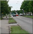
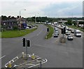
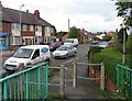
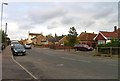
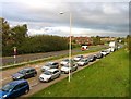
Photos of LE4 8AP

Area Information
Living in LE4 8AP means being part of a tightly knit residential cluster in England, where 1,703 people reside across a densely populated area of 1692 people per square kilometre. This small postcode area is defined by its compact layout, with homes predominantly occupied by owners, reflecting a stable, long-term community. The median age of 47 suggests a mature demographic, with adults aged 30–64 forming the largest age group. Daily life here is shaped by proximity to essential services, from nearby retail outlets like Sainsburys Leicester to accessible rail networks such as Leicester North and Syston Railway Station. The area’s low flood risk and below-average crime rate add to its appeal, offering a balance of safety and convenience. While the population density is high, the presence of multiple retail and transport hubs within practical reach ensures a self-contained lifestyle. For buyers, LE4 8AP represents a blend of practicality and quiet living, with homes primarily in private ownership and a focus on established, family-oriented living.
- Area Type
- Postcode
- Area Size
- Not available
- Population
- 1703
- Population Density
- 1692 people/km²
The property market in LE4 8AP is characterised by a high rate of home ownership, with 74% of properties occupied by their owners. This suggests a community of long-term residents rather than a transient rental market. The accommodation type is predominantly houses, which is unusual for a small postcode area but may indicate a mix of semi-detached or terraced homes. Given the high population density and limited land area, the housing stock is likely to be tightly packed, with properties designed for family living. For buyers, this means a focus on private ownership rather than investment in rental properties. The small size of the area means that the immediate surroundings—such as nearby villages or towns—may offer more housing options. However, the data does not specify property prices or trends, so buyers should consider the area’s compact nature and proximity to amenities when evaluating its appeal.
House Prices in LE4 8AP
No properties found in this postcode.
Energy Efficiency in LE4 8AP
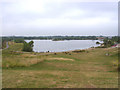
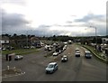
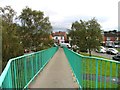
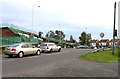
Residents of LE4 8AP have access to a range of nearby amenities that shape daily life. Retail options include Sainsburys Leicester, Co-op Wanlip, and Spar, providing essential shopping within walking or short driving distance. The area’s proximity to railway stations like Leicester North and Syston Railway Station enhances mobility, while the Great Central Railway offers additional transport links. Though the data does not mention parks or leisure facilities, the presence of multiple rail stations and retail hubs suggests a lifestyle focused on convenience and connectivity. The nearby Leicester Airport may also serve those requiring regional travel. While the data does not specify dining or cultural venues, the availability of major supermarkets and transport links implies a practical, service-oriented lifestyle. For families, the low crime rate and mature demographics may contribute to a stable, community-focused environment.
Amenities
Schools
| Rank | School | Type | Entry gender | Ages |
|---|
Explore more schools in this area
Go to Schools tabDemographics
The community in LE4 8AP is predominantly composed of adults aged 30–64, with a median age of 47. This suggests a mature, settled population, likely with long-term ties to the area. Home ownership is high, at 74%, indicating a strong preference for private residence over rental properties. The accommodation type is primarily houses, reflecting a residential character distinct from high-density housing. The predominant ethnic group is White, though no specific data on diversity or deprivation is provided. The population density of 1692 people per square kilometre implies a compact, closely spaced community, which may influence local amenities and social dynamics. While the data does not quantify deprivation levels, the high home ownership rate and low crime score suggest a stable environment with relatively few socioeconomic challenges. This profile aligns with a neighbourhood where long-term residents and families are likely to be the majority.
Household Size
Accommodation Type
Tenure
Ethnic Group
Religion
Household Composition
Age
Household Deprivation
NS-SEC
Explore more demographic insights in this area
Go to Demographics tabPlanning
Planning Constraints
- Flood RiskPremium
- Ramsar Wetland SitesPremium
- Area of Outstanding Natural BeautyPremium
- Protected Nature ReservePremium
- Protected WoodlandPremium
- Crime RiskPremium