Area Overview for LE4 7SJ
Photos of LE4 7SJ
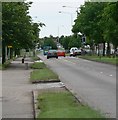
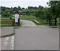
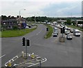
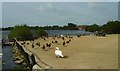
97 photos from this area
Area Information
Key information about the LE4 7SJ including its size, population, and administrative classification.
- Area Type
- Postcode
- Area Size
- 6.9 hectares
- Population
- 1437
- Population Density
- 1110 people/km²
House Prices in LE4 7SJ
21
Properties
£152,385
Average Sold Price
£62,000
Lowest Price
£325,000
Highest Price
Showing 21 properties
| Address | Type | Beds | Baths | Last Sale Price | Last Sale Date | |
|---|---|---|---|---|---|---|
| 559 Melton Road, Leicester, LE4 7SJ | house | 3 | 1 | £325,000 | Sep 2024 | |
| 555 Melton Road, Leicester, LE4 7SJ | Bungalow | 3 | - | £180,000 | Feb 2020 | |
| 547 Melton Road, Leicester, LE4 7SJ | Semi-detached | 3 | 1 | £217,000 | Oct 2017 | |
| 433 Melton Road, Leicester, LE4 7SJ | Semi-detached | 2 | - | £125,000 | Oct 2014 | |
| 549 Melton Road, Leicester, LE4 7SJ | house | - | - | £190,000 | Apr 2013 | |
| 543 Melton Road, Leicester, LE4 7SJ | house | 4 | - | £190,000 | Dec 2011 | |
| 427 Melton Road, Leicester, LE4 7SJ | Bungalow | - | - | £230,000 | Dec 2007 | |
| 545 Melton Road, Leicester, LE4 7SJ | house | - | - | £164,000 | Nov 2007 | |
| 557 Melton Road, Leicester, LE4 7SJ | house | - | - | £75,000 | Feb 2001 | |
| 441 Melton Road, Leicester, LE4 7SJ | house | - | - | £62,000 | Jan 2001 |
Page 1 of 3
Energy Efficiency in LE4 7SJ
Amenities
Schools
| Rank | School | Type | Entry gender | Ages |
|---|
Explore more schools in this area
Go to Schools tabDemographics
Household Size
Family (3-5 people)
most common
Accommodation Type
Houses
most common
Tenure
73
majority
Ethnic Group
asian_total
most common
Religion
N/A
most common
Household Composition
N/A
most common
Age
47
median
Adults (30-64 years)
most common
Household Deprivation
N/A
with no deprivation
NS-SEC
20
in Lower managerial occupations
Explore more demographic insights in this area
Go to Demographics tabPlanning
Planning Constraints
- Flood RiskPremium
- Ramsar Wetland SitesPremium
- Area of Outstanding Natural BeautyPremium
- Protected Nature ReservePremium
- Protected WoodlandPremium