Area Overview for LE4 7HJ
Photos of LE4 7HJ
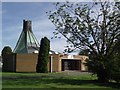
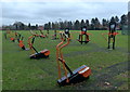
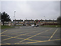
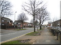
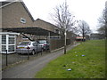
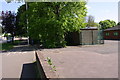
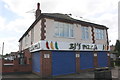
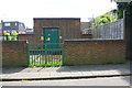
35 photos from this area
Area Information
Key information about the LE4 7HJ including its size, population, and administrative classification.
- Area Type
- Postcode
- Area Size
- 1.1 hectares
- Population
- 1727
- Population Density
- 5272 people/km²
House Prices in LE4 7HJ
19
Properties
£154,982
Average Sold Price
£58,500
Lowest Price
£285,000
Highest Price
Showing 19 properties
| Address | Type | Beds | Baths | Last Sale Price | Last Sale Date | |
|---|---|---|---|---|---|---|
| 43 Wyvern Avenue, Leicester, LE4 7HJ | house | - | - | £285,000 | Jun 2022 | |
| 49 Wyvern Avenue, Leicester, LE4 7HJ | Retail | 3 | 1 | £270,000 | Mar 2022 | |
| 45 Wyvern Avenue, Leicester, LE4 7HJ | house | - | - | £180,000 | Feb 2018 | |
| 39 Wyvern Avenue, Leicester, LE4 7HJ | Semi-detached | 3 | - | £182,000 | May 2015 | |
| 27 Wyvern Avenue, Leicester, LE4 7HJ | house | 3 | - | £132,000 | Oct 2013 | |
| 23 Wyvern Avenue, Leicester, LE4 7HJ | Semi-detached | - | - | £164,000 | Sep 2012 | |
| 35 Wyvern Avenue, Leicester, LE4 7HJ | house | 3 | - | £158,000 | Jul 2011 | |
| 37 Wyvern Avenue, Leicester, LE4 7HJ | Semi-detached | 3 | - | £141,000 | May 2008 | |
| 47 Wyvern Avenue, Leicester, LE4 7HJ | Semi-detached | - | - | £136,000 | Jun 2006 | |
| 41 Wyvern Avenue, Leicester, LE4 7HJ | Semi-detached | - | - | £170,000 | Dec 2005 |
Page 1 of 2
Energy Efficiency in LE4 7HJ
Amenities
Schools
| Rank | School | Type | Entry gender | Ages |
|---|
Explore more schools in this area
Go to Schools tabDemographics
Household Size
Family (3-5 people)
most common
Accommodation Type
Houses
most common
Tenure
72
majority
Ethnic Group
asian_total
most common
Religion
N/A
most common
Household Composition
N/A
most common
Age
47
median
Adults (30-64 years)
most common
Household Deprivation
N/A
with no deprivation
NS-SEC
17
in Lower managerial occupations
Explore more demographic insights in this area
Go to Demographics tabPlanning
Planning Constraints
- Flood RiskPremium
- Ramsar Wetland SitesPremium
- Area of Outstanding Natural BeautyPremium
- Protected Nature ReservePremium
- Protected WoodlandPremium