Area Overview for LE4 6EP
Photos of LE4 6EP
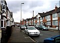
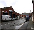
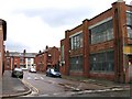
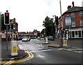
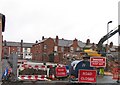
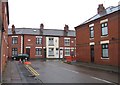
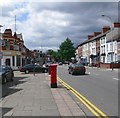
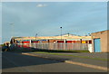
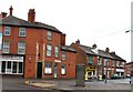
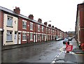
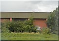
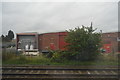
45 photos from this area
Area Information
Key information about the LE4 6EP including its size, population, and administrative classification.
- Area Type
- Postcode
- Area Size
- 7314 m²
- Population
- 1900
- Population Density
- 19628 people/km²
House Prices in LE4 6EP
21
Properties
£164,278
Average Sold Price
£88,000
Lowest Price
£300,000
Highest Price
Showing 21 properties
| Address | Type | Beds | Baths | Last Sale Price | Last Sale Date | |
|---|---|---|---|---|---|---|
| 91 Catherine Street, Leicester, LE4 6EP | house | - | - | £300,000 | Feb 2023 | |
| 139 Catherine Street, Leicester, LE4 6EP | Semi-detached | 3 | 2 | £282,500 | Apr 2020 | |
| 93 Catherine Street, Leicester, LE4 6EP | Detached | - | - | £140,000 | Jan 2017 | |
| 129 Catherine Street, Leicester, LE4 6EP | house | - | - | £140,000 | Apr 2016 | |
| 131 Catherine Street, Leicester, LE4 6EP | Semi-detached | 3 | - | £142,000 | Nov 2014 | |
| 135 Catherine Street, Leicester, LE4 6EP | house | - | - | £125,000 | Jul 2009 | |
| 81 Catherine Street, Leicester, LE4 6EP | Flat | - | - | £160,000 | Mar 2008 | |
| 125 Catherine Street, Leicester, LE4 6EP | Semi-detached | - | - | £101,000 | May 2005 | |
| 137 Catherine Street, Leicester, LE4 6EP | Semi-detached | - | - | £88,000 | Oct 2001 | |
| 85 Catherine Street, Leicester, LE4 6EP | Terraced | 4 | 2 | - | - |
Page 1 of 3
Energy Efficiency in LE4 6EP
Amenities
Schools
| Rank | School | Type | Entry gender | Ages |
|---|
Explore more schools in this area
Go to Schools tabDemographics
Household Size
Family (3-5 people)
most common
Accommodation Type
Houses
most common
Tenure
44
majority
Ethnic Group
asian_total
most common
Religion
N/A
most common
Household Composition
N/A
most common
Age
47
median
Adults (30-64 years)
most common
Household Deprivation
N/A
with no deprivation
NS-SEC
10
in Lower managerial occupations
Explore more demographic insights in this area
Go to Demographics tabPlanning
Planning Constraints
- Flood RiskPremium
- Ramsar Wetland SitesPremium
- Area of Outstanding Natural BeautyPremium
- Protected Nature ReservePremium
- Protected WoodlandPremium