Area Overview for LE4 5PS
Photos of LE4 5PS
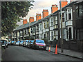
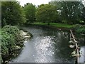
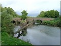
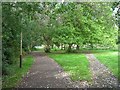
100 photos from this area
Area Information
Key information about the LE4 5PS including its size, population, and administrative classification.
- Area Type
- Postcode
- Area Size
- 1.9 hectares
- Population
- 1762
- Population Density
- 5675 people/km²
House Prices in LE4 5PS
9
Properties
£106,181
Average Sold Price
£33,000
Lowest Price
£205,000
Highest Price
Showing 9 properties
| Address | Type | Beds | Baths | Last Sale Price | Last Sale Date | |
|---|---|---|---|---|---|---|
| 11 Day Street, Leicester, LE4 5PS | house | - | - | £160,000 | Nov 2022 | |
| 5 Day Street, Leicester, LE4 5PS | house | 2 | 1 | £205,000 | Jul 2022 | |
| 9 Day Street, Leicester, LE4 5PS | Terraced | 2 | 1 | £103,000 | Aug 2015 | |
| 14 Day Street, Leicester, LE4 5PS | Bungalow | 2 | - | £90,000 | Oct 2013 | |
| 3 Day Street, Leicester, LE4 5PS | Terraced | - | - | £107,000 | Oct 2006 | |
| 7 Day Street, Leicester, LE4 5PS | house | - | - | £86,950 | Jul 2004 | |
| 12 Day Street, Leicester, LE4 5PS | house | - | - | £64,500 | May 2002 | |
| 1 Day Street, Leicester, LE4 5PS | Terraced | - | - | £33,000 | Nov 1999 | |
| 10 Day Street, Leicester, LE4 5PS | Semi-detached | - | - | - | - |
Energy Efficiency in LE4 5PS
Amenities
Schools
| Rank | School | Type | Entry gender | Ages |
|---|
Explore more schools in this area
Go to Schools tabDemographics
Household Size
Family (3-5 people)
most common
Accommodation Type
Houses
most common
Tenure
33
majority
Ethnic Group
asian_total
most common
Religion
N/A
most common
Household Composition
N/A
most common
Age
47
median
Adults (30-64 years)
most common
Household Deprivation
N/A
with no deprivation
NS-SEC
16
in Lower managerial occupations
Explore more demographic insights in this area
Go to Demographics tabPlanning
Planning Constraints
- Flood RiskPremium
- Ramsar Wetland SitesPremium
- Area of Outstanding Natural BeautyPremium
- Protected Nature ReservePremium
- Protected WoodlandPremium