Area Overview for LE4 5PB
Photos of LE4 5PB
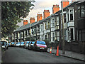
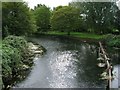
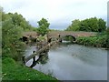
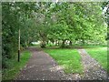
100 photos from this area
Area Information
Key information about the LE4 5PB including its size, population, and administrative classification.
- Area Type
- Postcode
- Area Size
- 5699 m²
- Population
- 1762
- Population Density
- 5675 people/km²
House Prices in LE4 5PB
31
Properties
£104,129
Average Sold Price
£33,000
Lowest Price
£220,000
Highest Price
Showing 31 properties
| Address | Type | Beds | Baths | Last Sale Price | Last Sale Date | |
|---|---|---|---|---|---|---|
| 9 Belgrave Avenue, Leicester, LE4 5PB | house | - | - | £220,000 | Jun 2022 | |
| 53 Belgrave Avenue, Leicester, LE4 5PB | house | - | - | £200,000 | Nov 2020 | |
| 25 Belgrave Avenue, Leicester, LE4 5PB | Terraced | 2 | 1 | £127,000 | Apr 2016 | |
| 43 Belgrave Avenue, Leicester, LE4 5PB | Terraced | 2 | - | £127,500 | Jun 2014 | |
| 55 Belgrave Avenue, Leicester, LE4 5PB | house | 3 | - | £147,500 | Jul 2012 | |
| 19 Belgrave Avenue, Leicester, LE4 5PB | house | 2 | - | £103,000 | Nov 2011 | |
| 31 Belgrave Avenue, Leicester, LE4 5PB | house | 2 | - | £102,500 | Sep 2010 | |
| 21 Belgrave Avenue, Leicester, LE4 5PB | house | - | - | £107,000 | Jan 2009 | |
| 11 Belgrave Avenue, Leicester, LE4 5PB | Terraced | - | - | £127,000 | Apr 2008 | |
| 1A Belgrave Avenue, Leicester, LE4 5PB | Semi-detached | - | - | £115,000 | Feb 2007 |
Page 1 of 4
Energy Efficiency in LE4 5PB
Amenities
Schools
| Rank | School | Type | Entry gender | Ages |
|---|
Explore more schools in this area
Go to Schools tabDemographics
Household Size
Family (3-5 people)
most common
Accommodation Type
Houses
most common
Tenure
33
majority
Ethnic Group
asian_total
most common
Religion
N/A
most common
Household Composition
N/A
most common
Age
47
median
Adults (30-64 years)
most common
Household Deprivation
N/A
with no deprivation
NS-SEC
16
in Lower managerial occupations
Explore more demographic insights in this area
Go to Demographics tabPlanning
Planning Constraints
- Flood RiskPremium
- Ramsar Wetland SitesPremium
- Area of Outstanding Natural BeautyPremium
- Protected Nature ReservePremium
- Protected WoodlandPremium