Area Overview for LE4 5DT
Photos of LE4 5DT
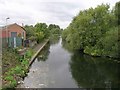
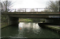
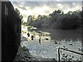
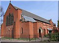
100 photos from this area
Area Information
Key information about the LE4 5DT including its size, population, and administrative classification.
- Area Type
- Postcode
- Area Size
- 6723 m²
- Population
- 2190
- Population Density
- 13281 people/km²
House Prices in LE4 5DT
16
Properties
£382,125
Average Sold Price
£56,000
Lowest Price
£1,460,000
Highest Price
Showing 16 properties
| Address | Type | Beds | Baths | Last Sale Price | Last Sale Date | |
|---|---|---|---|---|---|---|
| 46 Windsor Avenue, Leicester, LE4 5DT | house | - | - | £290,000 | Nov 2023 | |
| Gokul Nivas, 12-14 Windsor Avenue, Leicester, LE4 5DT | hospital_care_home | - | - | £1,460,000 | Jul 2023 | |
| 48 Windsor Avenue, Leicester, LE4 5DT | house | 3 | 1 | £310,000 | Jun 2022 | |
| 20 Windsor Avenue, Leicester, LE4 5DT | Detached | 5 | 1 | £420,000 | Aug 2019 | |
| 38 Windsor Avenue, Leicester, LE4 5DT | house | 3 | - | £159,000 | Oct 2012 | |
| 40 Windsor Avenue, Leicester, LE4 5DT | house | - | - | £175,000 | Dec 2010 | |
| 36 Windsor Avenue, Leicester, LE4 5DT | Detached | - | - | £187,000 | Nov 2007 | |
| 50 Windsor Avenue, Leicester, LE4 5DT | Terraced | - | - | £56,000 | Apr 2001 | |
| 34 Windsor Avenue, Leicester, LE4 5DT | Detached | - | - | - | - | |
| 32 Windsor Avenue, Leicester, LE4 5DT | Terraced | - | - | - | - |
Page 1 of 2
Energy Efficiency in LE4 5DT
Amenities
Schools
| Rank | School | Type | Entry gender | Ages |
|---|
Explore more schools in this area
Go to Schools tabDemographics
Household Size
Family (3-5 people)
most common
Accommodation Type
Houses
most common
Tenure
34
majority
Ethnic Group
asian_total
most common
Religion
N/A
most common
Household Composition
N/A
most common
Age
47
median
Adults (30-64 years)
most common
Household Deprivation
N/A
with no deprivation
NS-SEC
9
in Lower managerial occupations
Explore more demographic insights in this area
Go to Demographics tabPlanning
Planning Constraints
- Flood RiskPremium
- Ramsar Wetland SitesPremium
- Area of Outstanding Natural BeautyPremium
- Protected Nature ReservePremium
- Protected WoodlandPremium