Area Overview for LE4 4LL
Photos of LE4 4LL
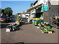
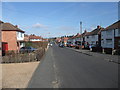
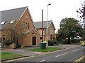
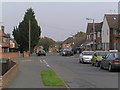
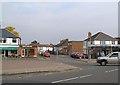
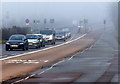
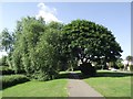
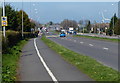
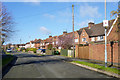
68 photos from this area
Area Information
Key information about the LE4 4LL including its size, population, and administrative classification.
- Area Type
- Postcode
- Area Size
- 1.0 hectares
- Population
- 1863
- Population Density
- 5507 people/km²
House Prices in LE4 4LL
32
Properties
£143,106
Average Sold Price
£35,000
Lowest Price
£350,000
Highest Price
Showing 32 properties
| Address | Type | Beds | Baths | Last Sale Price | Last Sale Date | |
|---|---|---|---|---|---|---|
| 63 Hill Rise, Birstall, LE4 4LL | Semi-detached | 3 | 1 | £310,000 | Feb 2025 | |
| 23 Hill Rise, Birstall, LE4 4LL | Semi-detached | 3 | 2 | £350,000 | Jun 2023 | |
| 41 Hill Rise, Birstall, LE4 4LL | house | - | - | £250,000 | Feb 2022 | |
| 17 Hill Rise, Birstall, LE4 4LL | house | - | - | £195,000 | Jun 2021 | |
| 27 Hill Rise, Birstall, LE4 4LL | Semi-detached | - | - | £210,000 | Oct 2019 | |
| 15 Hill Rise, Birstall, LE4 4LL | Semi-detached | 3 | 1 | £158,000 | May 2017 | |
| 37 Hill Rise, Birstall, LE4 4LL | Semi-detached | 3 | 1 | £165,000 | Jul 2016 | |
| 65 Hill Rise, Birstall, LE4 4LL | Semi-detached | 3 | 1 | £157,000 | May 2016 | |
| 39 Hill Rise, Birstall, LE4 4LL | Semi-detached | 3 | 3 | £199,950 | Mar 2015 | |
| 53 Hill Rise, Birstall, LE4 4LL | Semi-detached | 2 | 1 | £143,500 | Jan 2011 |
Page 1 of 4
Energy Efficiency in LE4 4LL
Amenities
Schools
| Rank | School | Type | Entry gender | Ages |
|---|
Explore more schools in this area
Go to Schools tabDemographics
Household Size
Family (3-5 people)
most common
Accommodation Type
Houses
most common
Tenure
79
majority
Ethnic Group
White
most common
Religion
N/A
most common
Household Composition
N/A
most common
Age
47
median
Adults (30-64 years)
most common
Household Deprivation
N/A
with no deprivation
NS-SEC
29
in Lower managerial occupations
Explore more demographic insights in this area
Go to Demographics tabPlanning
Planning Constraints
- Flood RiskPremium
- Ramsar Wetland SitesPremium
- Area of Outstanding Natural BeautyPremium
- Protected Nature ReservePremium
- Protected WoodlandPremium