Area Overview for LE4 4JF
Photos of LE4 4JF
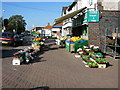
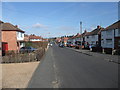
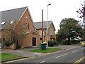
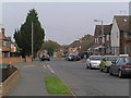
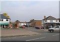
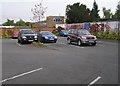
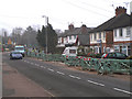
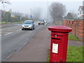
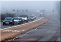
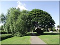
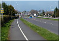
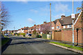
68 photos from this area
Area Information
Key information about the LE4 4JF including its size, population, and administrative classification.
- Area Type
- Postcode
- Area Size
- 5364 m²
- Population
- 1863
- Population Density
- 5507 people/km²
House Prices in LE4 4JF
18
Properties
£153,278
Average Sold Price
£54,000
Lowest Price
£257,000
Highest Price
Showing 18 properties
| Address | Type | Beds | Baths | Last Sale Price | Last Sale Date | |
|---|---|---|---|---|---|---|
| 57 Stonehill Avenue, Birstall, LE4 4JF | Semi-detached | 2 | 1 | £230,000 | Aug 2025 | |
| 67 Stonehill Avenue, Birstall, LE4 4JF | Semi-detached | 3 | 1 | £187,000 | Nov 2024 | |
| 69 Stonehill Avenue, Birstall, LE4 4JF | Semi-detached | 2 | 1 | £225,000 | Mar 2024 | |
| 75 Stonehill Avenue, Birstall, LE4 4JF | Semi-detached | 3 | 1 | £257,000 | Jun 2022 | |
| 71 Stonehill Avenue, Birstall, LE4 4JF | house | 3 | - | £220,000 | Aug 2021 | |
| 73 Stonehill Avenue, Birstall, LE4 4JF | Semi-detached | 3 | 2 | £217,000 | May 2021 | |
| 79 Stonehill Avenue, Birstall, LE4 4JF | Semi-detached | 3 | - | £172,500 | Mar 2021 | |
| 51 Stonehill Avenue, Birstall, LE4 4JF | Semi-detached | 3 | 1 | £197,000 | Jan 2020 | |
| 53 Stonehill Avenue, Birstall, LE4 4JF | Semi-detached | 3 | 1 | £173,500 | Jun 2017 | |
| 63 Stonehill Avenue, Birstall, LE4 4JF | house | 2 | 1 | £114,500 | Oct 2009 |
Page 1 of 2
Energy Efficiency in LE4 4JF
Amenities
Schools
| Rank | School | Type | Entry gender | Ages |
|---|
Explore more schools in this area
Go to Schools tabDemographics
Household Size
Family (3-5 people)
most common
Accommodation Type
Houses
most common
Tenure
79
majority
Ethnic Group
White
most common
Religion
N/A
most common
Household Composition
N/A
most common
Age
47
median
Adults (30-64 years)
most common
Household Deprivation
N/A
with no deprivation
NS-SEC
29
in Lower managerial occupations
Explore more demographic insights in this area
Go to Demographics tabPlanning
Planning Constraints
- Flood RiskPremium
- Ramsar Wetland SitesPremium
- Area of Outstanding Natural BeautyPremium
- Protected Nature ReservePremium
- Protected WoodlandPremium