Area Overview for LE4 4HB
Photos of LE4 4HB
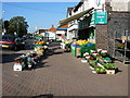
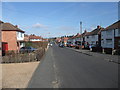
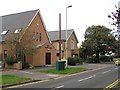
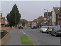
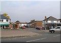

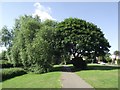
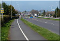
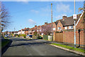
68 photos from this area
Area Information
Key information about the LE4 4HB including its size, population, and administrative classification.
- Area Type
- Postcode
- Area Size
- 7858 m²
- Population
- 1646
- Population Density
- 6621 people/km²
House Prices in LE4 4HB
21
Properties
£150,723
Average Sold Price
£43,000
Lowest Price
£265,000
Highest Price
Showing 21 properties
| Address | Type | Beds | Baths | Last Sale Price | Last Sale Date | |
|---|---|---|---|---|---|---|
| 7 Acacia Avenue, Birstall, LE4 4HB | house | 3 | 1 | £265,000 | Feb 2023 | |
| 25 Acacia Avenue, Birstall, LE4 4HB | Semi-detached | 3 | 1 | £230,000 | Nov 2022 | |
| 31 Acacia Avenue, Birstall, LE4 4HB | house | - | - | £200,000 | Nov 2017 | |
| 5 Acacia Avenue, Birstall, LE4 4HB | Semi-detached | 3 | 1 | £193,000 | Oct 2017 | |
| 21 Acacia Avenue, Birstall, LE4 4HB | house | - | - | £155,000 | Sep 2012 | |
| 41 Acacia Avenue, Birstall, LE4 4HB | Semi-detached | 3 | 1 | £117,000 | Feb 2007 | |
| 15 Acacia Avenue, Birstall, LE4 4HB | Semi-detached | - | - | £149,950 | Apr 2006 | |
| 9 Acacia Avenue, Birstall, LE4 4HB | Semi-detached | - | - | £144,500 | Sep 2005 | |
| 13 Acacia Avenue, Birstall, LE4 4HB | Semi-detached | - | - | £96,000 | May 2002 | |
| 11 Acacia Avenue, Birstall, LE4 4HB | Semi-detached | - | - | £64,500 | May 1999 |
Page 1 of 3
Energy Efficiency in LE4 4HB
Amenities
Schools
| Rank | School | Type | Entry gender | Ages |
|---|
Explore more schools in this area
Go to Schools tabDemographics
Household Size
Family (3-5 people)
most common
Accommodation Type
Houses
most common
Tenure
76
majority
Ethnic Group
White
most common
Religion
N/A
most common
Household Composition
N/A
most common
Age
47
median
Adults (30-64 years)
most common
Household Deprivation
N/A
with no deprivation
NS-SEC
27
in Lower managerial occupations
Explore more demographic insights in this area
Go to Demographics tabPlanning
Planning Constraints
- Flood RiskPremium
- Ramsar Wetland SitesPremium
- Area of Outstanding Natural BeautyPremium
- Protected Nature ReservePremium
- Protected WoodlandPremium