Area Overview for LE4 4GA
Photos of LE4 4GA
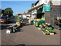
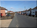
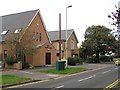
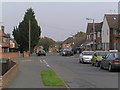
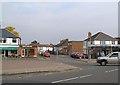
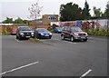
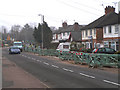
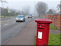

68 photos from this area
Area Information
Key information about the LE4 4GA including its size, population, and administrative classification.
- Area Type
- Postcode
- Area Size
- 1.2 hectares
- Population
- 1433
- Population Density
- 1640 people/km²
House Prices in LE4 4GA
29
Properties
£176,850
Average Sold Price
£69,950
Lowest Price
£325,000
Highest Price
Showing 29 properties
| Address | Type | Beds | Baths | Last Sale Price | Last Sale Date | |
|---|---|---|---|---|---|---|
| 10 Orchard Road, Birstall, LE4 4GA | Semi-detached | 3 | 1 | £255,000 | Mar 2024 | |
| 40 Orchard Road, Birstall, LE4 4GA | Semi-detached | 3 | 1 | £325,000 | Dec 2022 | |
| 14 Orchard Road, Birstall, LE4 4GA | house | 4 | - | £232,500 | Mar 2020 | |
| 50 Orchard Road, Birstall, LE4 4GA | Semi-detached | 3 | 2 | £225,000 | Jul 2018 | |
| 6 Orchard Road, Birstall, LE4 4GA | house | - | - | £210,000 | Jan 2018 | |
| 18 Orchard Road, Birstall, LE4 4GA | Detached | 4 | 2 | £239,950 | Nov 2014 | |
| 32 Orchard Road, Birstall, LE4 4GA | house | - | - | £155,000 | Jul 2013 | |
| 20 Orchard Road, Birstall, LE4 4GA | Semi-detached | - | - | £146,000 | Jul 2012 | |
| 24 Orchard Road, Birstall, LE4 4GA | house | - | - | £150,000 | Dec 2011 | |
| 28 Orchard Road, Birstall, LE4 4GA | Semi-detached | 3 | - | £122,000 | Mar 2009 |
Page 1 of 3
Energy Efficiency in LE4 4GA
Amenities
Schools
| Rank | School | Type | Entry gender | Ages |
|---|
Explore more schools in this area
Go to Schools tabDemographics
Household Size
Two person
most common
Accommodation Type
Houses
most common
Tenure
86
majority
Ethnic Group
White
most common
Religion
N/A
most common
Household Composition
N/A
most common
Age
47
median
Adults (30-64 years)
most common
Household Deprivation
N/A
with no deprivation
NS-SEC
26
in Lower managerial occupations
Explore more demographic insights in this area
Go to Demographics tabPlanning
Planning Constraints
- Flood RiskPremium
- Ramsar Wetland SitesPremium
- Area of Outstanding Natural BeautyPremium
- Protected Nature ReservePremium
- Protected WoodlandPremium