Area Overview for LE4 4BG
Photos of LE4 4BG
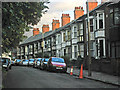
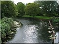
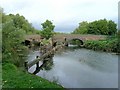
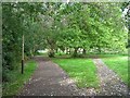
100 photos from this area
Area Information
Key information about the LE4 4BG including its size, population, and administrative classification.
- Area Type
- Postcode
- Area Size
- 5832 m²
- Population
- 1726
- Population Density
- 2803 people/km²
House Prices in LE4 4BG
11
Properties
£183,681
Average Sold Price
£54,500
Lowest Price
£367,000
Highest Price
Showing 11 properties
| Address | Type | Beds | Baths | Last Sale Price | Last Sale Date | |
|---|---|---|---|---|---|---|
| 381 Loughborough Road, Birstall, LE4 4BG | Detached | 4 | 1 | £367,000 | Jul 2020 | |
| 365 Loughborough Road, Birstall, LE4 4BG | Detached | 3 | 1 | £270,000 | Sep 2019 | |
| 385 Loughborough Road, Birstall, LE4 4BG | Terraced | 3 | 1 | £178,000 | May 2018 | |
| 373 Loughborough Road, Birstall, LE4 4BG | Detached | 4 | - | £250,000 | Aug 2014 | |
| 383 Loughborough Road, Birstall, LE4 4BG | house | 2 | - | £105,000 | Jun 2012 | |
| 367 Loughborough Road, Birstall, LE4 4BG | house | - | - | £185,000 | Aug 2009 | |
| 387 Loughborough Road, Birstall, LE4 4BG | Terraced | - | - | £54,500 | Aug 1996 | |
| 371 Loughborough Road, Birstall, LE4 4BG | Detached | 3 | 2 | £59,950 | Nov 1995 | |
| 363 Loughborough Road, Birstall, LE4 4BG | Detached | 4 | 2 | - | - | |
| 375 Loughborough Road, Birstall, LE4 4BG | Detached | 4 | 1 | - | - |
Page 1 of 2
Energy Efficiency in LE4 4BG
Amenities
Schools
| Rank | School | Type | Entry gender | Ages |
|---|
Explore more schools in this area
Go to Schools tabDemographics
Household Size
Two person
most common
Accommodation Type
Houses
most common
Tenure
85
majority
Ethnic Group
White
most common
Religion
N/A
most common
Household Composition
N/A
most common
Age
47
median
Adults (30-64 years)
most common
Household Deprivation
N/A
with no deprivation
NS-SEC
39
in Lower managerial occupations
Explore more demographic insights in this area
Go to Demographics tabPlanning
Planning Constraints
- Flood RiskPremium
- Ramsar Wetland SitesPremium
- Area of Outstanding Natural BeautyPremium
- Protected Nature ReservePremium
- Protected WoodlandPremium