Area Overview for LE4 3JQ
Photos of LE4 3JQ
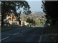
33 photos from this area
Area Information
Key information about the LE4 3JQ including its size, population, and administrative classification.
- Area Type
- Postcode
- Area Size
- 8460 m²
- Population
- 1626
- Population Density
- 5889 people/km²
House Prices in LE4 3JQ
22
Properties
£237,154
Average Sold Price
£143,500
Lowest Price
£355,000
Highest Price
Showing 22 properties
| Address | Type | Beds | Baths | Last Sale Price | Last Sale Date | |
|---|---|---|---|---|---|---|
| 30 Queensgate Drive, Birstall, LE4 3JQ | Semi-detached | 3 | 1 | £230,000 | Sep 2025 | |
| 2 Queensgate Drive, Birstall, LE4 3JQ | Semi-detached | 4 | 2 | £355,000 | Jul 2025 | |
| 18 Queensgate Drive, Birstall, LE4 3JQ | Semi-detached | - | - | £250,000 | Mar 2025 | |
| 20 Queensgate Drive, Birstall, LE4 3JQ | Semi-detached | 3 | 1 | £290,000 | Sep 2024 | |
| 38 Queensgate Drive, Birstall, LE4 3JQ | Semi-detached | 3 | 1 | £254,000 | Aug 2021 | |
| 16 Queensgate Drive, Birstall, LE4 3JQ | Detached | 3 | 1 | £260,000 | Dec 2020 | |
| 28 Queensgate Drive, Birstall, LE4 3JQ | house | 3 | 1 | £236,000 | Sep 2020 | |
| 22 Queensgate Drive, Birstall, LE4 3JQ | Semi-detached | 3 | 1 | £255,000 | Jul 2020 | |
| 32 Queensgate Drive, Birstall, LE4 3JQ | Semi-detached | 3 | 2 | £220,000 | Apr 2019 | |
| 10 Queensgate Drive, Birstall, LE4 3JQ | Semi-detached | 3 | 1 | £219,000 | Dec 2018 |
Page 1 of 3
Energy Efficiency in LE4 3JQ
Amenities
Schools
| Rank | School | Type | Entry gender | Ages |
|---|
Explore more schools in this area
Go to Schools tabDemographics
Household Size
Family (3-5 people)
most common
Accommodation Type
Houses
most common
Tenure
90
majority
Ethnic Group
White
most common
Religion
N/A
most common
Household Composition
N/A
most common
Age
47
median
Adults (30-64 years)
most common
Household Deprivation
N/A
with no deprivation
NS-SEC
34
in Lower managerial occupations
Explore more demographic insights in this area
Go to Demographics tabPlanning
Planning Constraints
- Flood RiskPremium
- Ramsar Wetland SitesPremium
- Area of Outstanding Natural BeautyPremium
- Protected Nature ReservePremium
- Protected WoodlandPremium