Area Overview for LE4 3FA
Photos of LE4 3FA
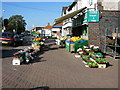
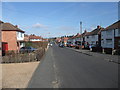
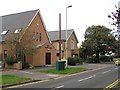
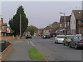
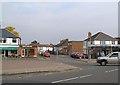
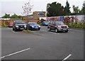
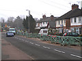
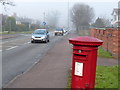

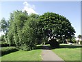
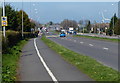
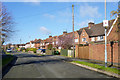
68 photos from this area
Area Information
Key information about the LE4 3FA including its size, population, and administrative classification.
- Area Type
- Postcode
- Area Size
- 1.0 hectares
- Population
- 1770
- Population Density
- 3916 people/km²
House Prices in LE4 3FA
20
Properties
£177,217
Average Sold Price
£47,000
Lowest Price
£325,000
Highest Price
Showing 20 properties
| Address | Type | Beds | Baths | Last Sale Price | Last Sale Date | |
|---|---|---|---|---|---|---|
| 4 Broadgate Close, Birstall, LE4 3FA | Bungalow | 2 | 1 | £262,000 | Jan 2025 | |
| 13 Broadgate Close, Birstall, LE4 3FA | Bungalow | 2 | 1 | £300,000 | Jul 2024 | |
| 7 Broadgate Close, Birstall, LE4 3FA | Bungalow | 2 | 1 | £325,000 | Aug 2022 | |
| 2 Broadgate Close, Birstall, LE4 3FA | Detached | 3 | 1 | £225,000 | Sep 2021 | |
| 20 Broadgate Close, Birstall, LE4 3FA | Semi-detached | 3 | - | £172,000 | Sep 2014 | |
| 16 Broadgate Close, Birstall, LE4 3FA | house | 3 | - | £165,000 | May 2012 | |
| 15 Broadgate Close, Birstall, LE4 3FA | house | 3 | 1 | £185,000 | Dec 2010 | |
| 10 Broadgate Close, Birstall, LE4 3FA | Bungalow | - | - | £170,000 | Mar 2010 | |
| 3 Broadgate Close, Birstall, LE4 3FA | Detached | - | - | £183,000 | Apr 2006 | |
| 9 Broadgate Close, Birstall, LE4 3FA | Bungalow | 2 | 1 | £163,750 | May 2004 |
Page 1 of 2
Energy Efficiency in LE4 3FA
Amenities
Schools
| Rank | School | Type | Entry gender | Ages |
|---|
Explore more schools in this area
Go to Schools tabDemographics
Household Size
Family (3-5 people)
most common
Accommodation Type
Houses
most common
Tenure
90
majority
Ethnic Group
White
most common
Religion
N/A
most common
Household Composition
N/A
most common
Age
47
median
Adults (30-64 years)
most common
Household Deprivation
N/A
with no deprivation
NS-SEC
39
in Lower managerial occupations
Explore more demographic insights in this area
Go to Demographics tabPlanning
Planning Constraints
- Flood RiskPremium
- Ramsar Wetland SitesPremium
- Area of Outstanding Natural BeautyPremium
- Protected Nature ReservePremium
- Protected WoodlandPremium