Area Overview for LE4 3AD
Photos of LE4 3AD
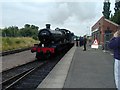
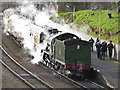
85 photos from this area
Area Information
Key information about the LE4 3AD including its size, population, and administrative classification.
- Area Type
- Postcode
- Area Size
- 10.5 hectares
- Population
- 1751
- Population Density
- 3838 people/km²
House Prices in LE4 3AD
20
Properties
£209,500
Average Sold Price
£76,000
Lowest Price
£432,500
Highest Price
Showing 20 properties
| Address | Type | Beds | Baths | Last Sale Price | Last Sale Date | |
|---|---|---|---|---|---|---|
| 50 Cliffe Road, Birstall, LE4 3AD | Detached | 2 | 1 | £290,000 | Jul 2022 | |
| 14 Cliffe Road, Birstall, LE4 3AD | Detached | 3 | - | £204,000 | Jun 2014 | |
| 52 Cliffe Road, Birstall, LE4 3AD | Detached | 4 | 1 | £432,500 | Feb 2014 | |
| 50A Cliffe Road, Birstall, LE4 3AD | house | - | - | £245,000 | Aug 2010 | |
| 36 Cliffe Road, Birstall, LE4 3AD | Detached | - | - | £240,000 | Dec 2005 | |
| 54 Cliffe Road, Birstall, LE4 3AD | Detached | 4 | 1 | £200,000 | Apr 2003 | |
| 12 Cliffe Road, Birstall, LE4 3AD | house | - | - | £76,000 | Mar 2001 | |
| 10 Cliffe Road, Birstall, LE4 3AD | Semi-detached | - | - | £79,000 | Jul 1999 | |
| 6 Cliffe Road, Birstall, LE4 3AD | Detached | - | - | £119,000 | Oct 1997 | |
| 46 Cliffe Road, Birstall, LE4 3AD | Bungalow | 2 | 1 | - | - |
Page 1 of 2
Energy Efficiency in LE4 3AD
Amenities
Schools
| Rank | School | Type | Entry gender | Ages |
|---|
Explore more schools in this area
Go to Schools tabDemographics
Household Size
Family (3-5 people)
most common
Accommodation Type
Houses
most common
Tenure
88
majority
Ethnic Group
White
most common
Religion
N/A
most common
Household Composition
N/A
most common
Age
47
median
Adults (30-64 years)
most common
Household Deprivation
N/A
with no deprivation
NS-SEC
41
in Lower managerial occupations
Explore more demographic insights in this area
Go to Demographics tabPlanning
Planning Constraints
- Flood RiskPremium
- Ramsar Wetland SitesPremium
- Area of Outstanding Natural BeautyPremium
- Protected Nature ReservePremium
- Protected WoodlandPremium