Area Overview for LE4 2XZ
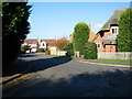
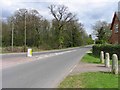
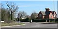
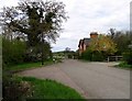
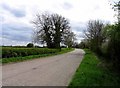
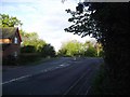
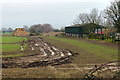
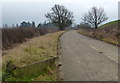
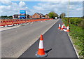
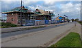
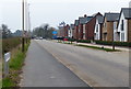
Photos of LE4 2XZ

Area Information
Living in LE4 2XZ offers a compact, residential experience shaped by its small cluster of homes and proximity to key services. With a population of 1,744 and a density of 594 people per square kilometre, the area is tightly knit, fostering a sense of community. The median age of 47 suggests a mature demographic, with most residents falling between 30 and 64 years old. This reflects a stable, family-oriented environment where homeownership is prevalent—79% of households own their homes. The area’s character is defined by its housing stock, which is predominantly single-family homes, catering to those seeking traditional living arrangements. Nearby, the presence of primary schools, retail outlets, and rail connections ensures daily needs are met without long commutes. While the area is small, its strategic location near major transport routes and amenities like Tesco and railway stations makes it practical for both commuters and those prioritising convenience. LE4 2XZ is not a sprawling suburb but a focused, self-contained community where familiarity with local services and neighbours is a given.
- Area Type
- Postcode
- Area Size
- Not available
- Population
- 1744
- Population Density
- 594 people/km²
The property market in LE4 2XZ is defined by high homeownership and a focus on single-family homes. With 79% of residents owning their homes, the area leans towards owner-occupation rather than rental activity, which may influence property values and demand. The predominance of houses over flats or apartments suggests a market catering to families or individuals prioritising space and private outdoor areas. This could make the area attractive to buyers seeking long-term investments, though the small size of the postcode means the housing stock is limited. For those considering the area, the mix of traditional homes and proximity to amenities like schools and retail might appeal to those valuing convenience without urban density. However, the limited scale of the area also means buyers should explore nearby postcodes for a broader range of options. The market’s stability, supported by low crime rates and good connectivity, could offer reassurance to prospective homeowners.
House Prices in LE4 2XZ
No properties found in this postcode.
Energy Efficiency in LE4 2XZ
The lifestyle in LE4 2XZ is supported by a range of amenities within practical reach. Retail options include Budgens Beaumont and Tesco Mowmacre, offering everyday shopping needs, while larger stores like Tesco Birstall provide additional choices. The area’s rail and metro connections, such as Syston Railway Station and Leicester North, enhance mobility, making it easy to access nearby towns or cities for leisure, work, or socialising. While specific parks or recreational spaces are not listed, the absence of environmental constraints like protected woodlands or AONBs suggests open spaces may be available nearby. The mix of retail, transport, and proximity to schools creates a balanced daily life, where residents can enjoy convenience without sacrificing accessibility. The character of the area is defined by its practicality—everyday needs are met locally, reducing the necessity for long commutes or detours. This makes LE4 2XZ appealing to those who value a self-sufficient yet connected lifestyle.
Amenities
Schools
Residents of LE4 2XZ have access to two primary schools within practical reach. Dovelands Junior School C.O. Glebelands Primary School serves younger children, while Glebelands Primary School, rated 'good' by Ofsted, offers a reliable educational foundation for families. The presence of two primary schools suggests a focus on early education, which is crucial for young families. Both institutions are likely to be central to the area’s community life, hosting events and fostering local connections. The 'good' rating at Glebelands Primary School indicates a school that meets or exceeds national standards, which can be a key factor for parents prioritising quality education. While secondary schools are not listed, the proximity to primary education makes the area appealing to those planning for their children’s schooling. The availability of nearby schools, combined with the area’s low crime risk, enhances its appeal as a family-friendly location.
| Rank | School | Type | Entry gender | Ages |
|---|
Explore more schools in this area
Go to Schools tabDemographics
The demographic profile of LE4 2XZ is marked by a median age of 47, with the majority of residents aged between 30 and 64. This suggests a population skewed towards middle-aged adults, likely settled in their careers and family life. Homeownership is high, with 79% of residents living in properties they own, indicating a preference for long-term stability. The accommodation type is predominantly houses, which aligns with the area’s residential character and may appeal to those seeking space and privacy. The predominant ethnic group is White, though specific diversity metrics are not provided. The age distribution and homeownership rate imply a community with established roots, where generational ties and local institutions are likely to be strong. The absence of data on deprivation or income levels means the quality of life cannot be fully assessed, but the low crime risk and lack of environmental constraints suggest a generally secure and manageable living environment.
Household Size
Accommodation Type
Tenure
Ethnic Group
Religion
Household Composition
Age
Household Deprivation
NS-SEC
Explore more demographic insights in this area
Go to Demographics tabPlanning
Planning Constraints
- Flood RiskPremium
- Ramsar Wetland SitesPremium
- Area of Outstanding Natural BeautyPremium
- Protected Nature ReservePremium
- Protected WoodlandPremium