Area Overview for LE4 2ND
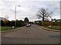
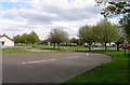
Photos of LE4 2ND
Area Information
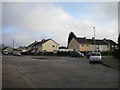
Living in LE4 2ND means inhabiting a compact, densely populated area of 524 m² that accommodates 2,171 residents. This postcode is a small residential cluster, characterised by its proximity to essential services and transport links. The area’s high population density—over 4 million people per square kilometre—suggests a tightly knit community, though the small size means it is not a sprawling suburb. Daily life here is shaped by the surrounding infrastructure, including retail outlets and railway stations. The demographic profile leans toward adults aged 30–64, with a median age of 47, indicating a mature population. While the area lacks large-scale amenities, its proximity to nearby towns and transport hubs offers flexibility. Residents benefit from excellent broadband connectivity, rated 100 out of 100, ensuring seamless internet access. However, the area’s compact nature means it is best suited for those prioritising convenience over expansive living spaces. For buyers, LE4 2ND represents a niche market where property choices are limited but focused on single-family homes, reflecting its predominantly owner-occupied character.
- Area Type
- Postcode
- Area Size
- 524 m²
- Population
- 2171
- Population Density
- 4125 people/km²
The property market in LE4 2ND is defined by its low home ownership rate of 34%, which implies a significant portion of the housing stock is rented out. Despite this, the accommodation type is predominantly houses, which is atypical for a small, densely populated area. This suggests a mix of older, standalone homes and possibly newer developments catering to renters. For buyers, the limited area size and high density mean property choices are constrained, though the focus on houses may appeal to those seeking private, single-family homes. The low home ownership rate could indicate a rental market dominated by landlords, potentially offering investment opportunities. However, the compact nature of LE4 2ND means buyers must consider proximity to nearby towns for larger properties. The area’s small footprint also limits scope for expansion, making it a niche market for those prioritising convenience over space.
House Prices in LE4 2ND
Showing 2 properties
| Address | Type | Beds | Baths | Last Sale Price | Last Sale Date | |
|---|---|---|---|---|---|---|
| 1 Morpeth Avenue, Leicester, LE4 2ND | Semi-detached | 3 | 1 | £115,000 | Jun 2016 | |
| 3 Morpeth Avenue, Leicester, LE4 2ND | Terraced | 3 | 1 | £89,500 | Jul 2007 |
Energy Efficiency in LE4 2ND
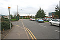
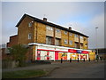
Residents of LE4 2ND have access to a range of nearby amenities, including five retail outlets such as Tesco Mowmacre, Morrisons Daily, and Budgens Beaumont. These shops provide essential services for daily living, from groceries to convenience items. The area’s rail and metro connections, including Leicester North and Syston stations, facilitate travel to larger towns and cities. While the data does not mention parks or leisure facilities, the presence of multiple railway stations suggests opportunities for weekend excursions or commuting to cultural centres. The compact nature of LE4 2ND means amenities are concentrated, requiring minimal travel for basic needs. However, the absence of detailed information on leisure options implies residents may need to look beyond the postcode for recreational activities. The combination of retail access and transport links creates a functional, if modest, lifestyle for those prioritising convenience over expansive facilities.
Amenities
Schools
The nearest school to LE4 2ND is Mowmacre Hill Primary School, which serves the local community. This primary school holds an Ofsted rating of ‘good’, indicating a satisfactory standard of education. The absence of secondary schools in the data suggests families may need to look beyond LE4 2ND for secondary education. The presence of a single primary school with a positive rating is a key consideration for families, though it may not meet the needs of larger households requiring multiple school options. The school’s rating implies adequate teaching quality and resources, but parents should verify if the school’s curriculum and facilities align with their child’s needs. For those prioritising proximity to educational institutions, Mowmacre Hill Primary School is a reliable option, though secondary schooling remains a practical concern for long-term residents.
| Rank | School | Type | Entry gender | Ages |
|---|
Explore more schools in this area
Go to Schools tabDemographics
The community in LE4 2ND is predominantly composed of adults aged 30–64, with a median age of 47. This suggests a population skewed toward middle-aged individuals, likely established professionals or families. Home ownership is relatively low at 34%, indicating a higher proportion of rental properties. The accommodation type is primarily houses, which is unusual for a densely populated area, suggesting a mix of older, standalone homes and newer developments. The predominant ethnic group is White, with no data provided on other demographics. The high population density—over 4 million people per square kilometre—raises questions about living conditions, though no specific deprivation data is available. For residents, this density may mean a close-knit community but also potential challenges with space and resources. The age profile suggests a stable population, though the low home ownership rate may reflect economic pressures or a transient demographic.
Household Size
Accommodation Type
Tenure
Ethnic Group
Religion
Household Composition
Age
Household Deprivation
NS-SEC
Explore more demographic insights in this area
Go to Demographics tabPlanning
Planning Constraints
- Flood RiskPremium
- Ramsar Wetland SitesPremium
- Area of Outstanding Natural BeautyPremium
- Protected Nature ReservePremium
- Protected WoodlandPremium