Area Overview for LE4 2NB
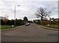
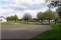
Photos of LE4 2NB
Area Information
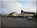
Living in LE4 2NB means inhabiting a tightly packed residential cluster in England, where 2,171 people reside across just 2,672 square metres. This creates a densely populated environment, with over 800,000 people per square kilometre — a stark contrast to the national average. The area’s compact size fosters a sense of proximity, with neighbours likely to be just a short walk away. Daily life here is shaped by its small-scale nature, where local amenities and services are within practical reach. The community is predominantly composed of adults aged 30–64, suggesting a mature, established demographic. While the area lacks expansive green spaces or major landmarks, its strength lies in its accessibility to nearby towns and transport networks. For those seeking a quiet, close-knit living environment with minimal commuting distances, LE4 2NB offers a compact alternative to sprawling suburbs. However, the high population density may mean limited private space, requiring residents to prioritise shared community areas or nearby parks for recreation.
- Area Type
- Postcode
- Area Size
- 2672 m²
- Population
- 2171
- Population Density
- 4125 people/km²
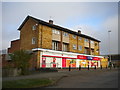
The property market in LE4 2NB is characterised by a 34% home ownership rate, indicating that most residents rent rather than own their homes. The area’s accommodation type is predominantly houses, which is unusual for a small, densely populated postcode. This suggests a mix of owner-occupied and rental properties, though the low home ownership rate implies limited availability of long-term buy-to-live options. The compact size of the area means housing stock is likely limited, with competition for available properties. For buyers, this presents challenges: the small footprint restricts development, and the high population density may reduce privacy. However, the presence of houses rather than flats could appeal to those seeking more space. Prospective buyers should consider the area’s proximity to transport links and amenities, which may offset its limitations. The market’s dynamics are likely influenced by nearby towns, where larger housing options might be more accessible.
House Prices in LE4 2NB
Showing 12 properties
| Address | Type | Beds | Baths | Last Sale Price | Last Sale Date | |
|---|---|---|---|---|---|---|
| 54 Morpeth Avenue, Leicester, LE4 2NB | Semi-detached | 3 | 1 | £215,000 | Feb 2025 | |
| 52 Morpeth Avenue, Leicester, LE4 2NB | house | 3 | 1 | £80,000 | Oct 2014 | |
| 46 Morpeth Avenue, Leicester, LE4 2NB | Semi-detached | 3 | - | £95,000 | Dec 2013 | |
| 48 Morpeth Avenue, Leicester, LE4 2NB | house | - | - | £87,000 | Sep 2012 | |
| 50 Morpeth Avenue, Leicester, LE4 2NB | house | - | - | £76,000 | Aug 2011 | |
| 36 Morpeth Avenue, Leicester, LE4 2NB | house | - | - | £46,000 | Jan 2003 | |
| 40 Morpeth Avenue, Leicester, LE4 2NB | house | - | - | - | - | |
| 38 Morpeth Avenue, Leicester, LE4 2NB | house | - | - | - | - | |
| 34 Morpeth Avenue, Leicester, LE4 2NB | Terraced | - | - | - | - | |
| 56 Morpeth Avenue, Leicester, LE4 2NB | house | - | - | - | - |
Energy Efficiency in LE4 2NB
Residents of LE4 2NB have access to a range of nearby amenities within practical reach. Retail options include Tesco Mowmacre, Morrisons Daily, and Tesco Leicester, providing essential shopping and grocery needs. The area’s proximity to rail stations such as Leicester, Syston, and Sileby enhances mobility, connecting residents to broader regional networks. Metro services like the Great Central Railway and Rothley offer additional transport choices. While the area itself is small, its placement near larger towns means residents can access a wider array of leisure, dining, and cultural facilities beyond the immediate postcode. The presence of multiple retail outlets and transport hubs contributes to a functional daily life, though the lack of expansive parks or recreational spaces may require trips to nearby areas for outdoor activities. The compact nature of LE4 2NB ensures that essential services are close, though it may not cater to those seeking extensive local amenities.
Amenities
Schools
The nearest school to LE4 2NB is Mowmacre Hill Primary School, which serves the local community with primary education. The school has an Ofsted rating of ‘good’, indicating a satisfactory standard of teaching and facilities. As the only named school in the area, it is the primary educational institution for nearby residents. The absence of secondary schools or additional educational institutions within the postcode suggests that families may need to travel to adjacent areas for higher education. For parents prioritising primary schooling, Mowmacre Hill’s rating offers reassurance, though the lack of diversity in school types may limit options for older children. The school’s presence contributes to the area’s appeal for families, though its single-tier structure means broader educational needs must be met elsewhere.
| Rank | School | Type | Entry gender | Ages |
|---|
Explore more schools in this area
Go to Schools tabDemographics
The population of LE4 2NB is 2,171, with a median age of 47, reflecting a mature community where most residents are in their 30s to 60s. Over two-thirds of the population fall within the 30–64 age range, indicating a stable, working-age demographic. Home ownership rates are relatively low at 34%, suggesting a rental market dominates, with houses being the primary accommodation type. The predominant ethnic group is White, though no specific data on diversity or deprivation levels is provided. The high population density — 812,577 people per square kilometre — implies tightly packed living conditions, which may influence access to private outdoor space. This density also means communal areas and local services are likely to be heavily used, shaping a lifestyle centred around shared resources and proximity to amenities. The age profile suggests a community with established careers and families, though younger or retired residents are less represented.
Household Size
Accommodation Type
Tenure
Ethnic Group
Religion
Household Composition
Age
Household Deprivation
NS-SEC
Explore more demographic insights in this area
Go to Demographics tabPlanning
Planning Constraints
- Flood RiskPremium
- Ramsar Wetland SitesPremium
- Area of Outstanding Natural BeautyPremium
- Protected Nature ReservePremium
- Protected WoodlandPremium