Area Overview for LE4 2FL
Photos of LE4 2FL
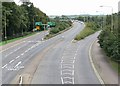
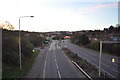
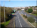


53 photos from this area
Area Information
Key information about the LE4 2FL including its size, population, and administrative classification.
- Area Type
- Postcode
- Area Size
- 1.2 hectares
- Population
- 1750
- Population Density
- 3831 people/km²
House Prices in LE4 2FL
61
Properties
£133,445
Average Sold Price
£59,950
Lowest Price
£218,000
Highest Price
Showing 61 properties
| Address | Type | Beds | Baths | Last Sale Price | Last Sale Date | |
|---|---|---|---|---|---|---|
| 74 Kinley Road, Leicester, LE4 2FL | Flat | - | - | £79,000 | Dec 2024 | |
| 117 Kinley Road, Leicester, LE4 2FL | Terraced | 3 | 1 | £215,000 | Dec 2023 | |
| 119 Kinley Road, Leicester, LE4 2FL | Terraced | 3 | 1 | £218,000 | May 2023 | |
| 75 Kinley Road, Leicester, LE4 2FL | house | - | - | £155,000 | Feb 2022 | |
| 103 Kinley Road, Leicester, LE4 2FL | house | - | - | £177,000 | Jun 2020 | |
| 121 Kinley Road, Leicester, LE4 2FL | Terraced | 3 | 1 | £135,000 | Mar 2019 | |
| 105 Kinley Road, Leicester, LE4 2FL | Terraced | 2 | 1 | £109,500 | Oct 2016 | |
| 101 Kinley Road, Leicester, LE4 2FL | Terraced | - | - | £92,000 | Sep 2008 | |
| 79 Kinley Road, Leicester, LE4 2FL | house | - | - | £94,000 | May 2007 | |
| 108 Kinley Road, Leicester, LE4 2FL | Flat | - | - | £59,950 | Jan 2007 |
Page 1 of 7
Energy Efficiency in LE4 2FL
Amenities
Schools
| Rank | School | Type | Entry gender | Ages |
|---|
Explore more schools in this area
Go to Schools tabDemographics
Household Size
One person
most common
Accommodation Type
Houses
most common
Tenure
27
majority
Ethnic Group
White
most common
Religion
N/A
most common
Household Composition
N/A
most common
Age
47
median
Adults (30-64 years)
most common
Household Deprivation
N/A
with no deprivation
NS-SEC
13
in Lower managerial occupations
Explore more demographic insights in this area
Go to Demographics tabPlanning
Planning Constraints
- Flood RiskPremium
- Ramsar Wetland SitesPremium
- Area of Outstanding Natural BeautyPremium
- Protected Nature ReservePremium
- Protected WoodlandPremium