Area Overview for LE4 2BH
Photos of LE4 2BH
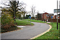
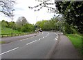
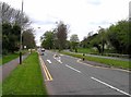
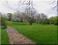
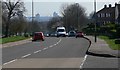
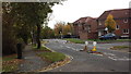
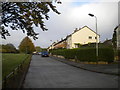
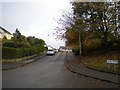
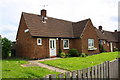
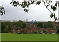
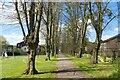
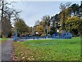
26 photos from this area
Area Information
Key information about the LE4 2BH including its size, population, and administrative classification.
- Area Type
- Postcode
- Area Size
- 1.6 hectares
- Population
- 1891
- Population Density
- 5692 people/km²
House Prices in LE4 2BH
29
Properties
£146,154
Average Sold Price
£38,000
Lowest Price
£277,000
Highest Price
Showing 29 properties
| Address | Type | Beds | Baths | Last Sale Price | Last Sale Date | |
|---|---|---|---|---|---|---|
| 447 Beaumont Leys Lane, Leicester, LE4 2BH | house | 3 | 1 | £277,000 | Sep 2025 | |
| 439 Beaumont Leys Lane, Leicester, LE4 2BH | Detached | 3 | 1 | £250,000 | Jul 2025 | |
| 413 Beaumont Leys Lane, Leicester, LE4 2BH | house | - | - | £200,000 | Feb 2024 | |
| 409 Beaumont Leys Lane, Leicester, LE4 2BH | Retail | 3 | 2 | £217,000 | Jan 2022 | |
| 441 Beaumont Leys Lane, Leicester, LE4 2BH | house | - | - | £158,000 | Aug 2017 | |
| 397 Beaumont Leys Lane, Leicester, LE4 2BH | Semi-detached | 3 | - | £148,000 | Nov 2016 | |
| 405 Beaumont Leys Lane, Leicester, LE4 2BH | house | 3 | 1 | £126,000 | Mar 2016 | |
| 411 Beaumont Leys Lane, Leicester, LE4 2BH | Semi-detached | 3 | 1 | £123,000 | Jul 2015 | |
| 417 Beaumont Leys Lane, Leicester, LE4 2BH | Terraced | 3 | 1 | £89,000 | May 2012 | |
| 399 Beaumont Leys Lane, Leicester, LE4 2BH | Semi-detached | - | - | £82,000 | May 2012 |
Page 1 of 3
Energy Efficiency in LE4 2BH
Amenities
Schools
| Rank | School | Type | Entry gender | Ages |
|---|
Explore more schools in this area
Go to Schools tabDemographics
Household Size
Family (3-5 people)
most common
Accommodation Type
Houses
most common
Tenure
52
majority
Ethnic Group
White
most common
Religion
N/A
most common
Household Composition
N/A
most common
Age
47
median
Adults (30-64 years)
most common
Household Deprivation
N/A
with no deprivation
NS-SEC
11
in Lower managerial occupations
Explore more demographic insights in this area
Go to Demographics tabPlanning
Planning Constraints
- Flood RiskPremium
- Ramsar Wetland SitesPremium
- Area of Outstanding Natural BeautyPremium
- Protected Nature ReservePremium
- Protected WoodlandPremium