Area Overview for LE4 2AT
Photos of LE4 2AT
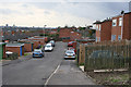
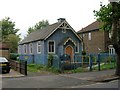
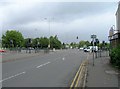
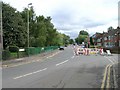
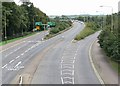
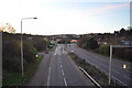
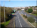

53 photos from this area
Area Information
Key information about the LE4 2AT including its size, population, and administrative classification.
- Area Type
- Postcode
- Area Size
- 1.2 hectares
- Population
- 2091
- Population Density
- 3867 people/km²
House Prices in LE4 2AT
35
Properties
£144,261
Average Sold Price
£42,500
Lowest Price
£275,000
Highest Price
Showing 35 properties
| Address | Type | Beds | Baths | Last Sale Price | Last Sale Date | |
|---|---|---|---|---|---|---|
| 45 Orton Road, Leicester, LE4 2AT | Cottage | 2 | 1 | £205,000 | Mar 2025 | |
| 61A Orton Road, Leicester, LE4 2AT | Bungalow | 2 | 1 | £157,500 | Sep 2023 | |
| 65 Orton Road, Leicester, LE4 2AT | Bungalow | 4 | 1 | £275,000 | Jun 2022 | |
| 41 Orton Road, Leicester, LE4 2AT | house | - | - | £250,000 | Aug 2021 | |
| 5 Orton Road, Leicester, LE4 2AT | house | - | - | £251,000 | Jun 2021 | |
| 47 Orton Road, Leicester, LE4 2AT | Semi-detached | 2 | 1 | £165,000 | Feb 2021 | |
| 11 Orton Road, Leicester, LE4 2AT | Bungalow | 2 | - | £146,000 | Nov 2019 | |
| 55 Orton Road, Leicester, LE4 2AT | Terraced | 2 | - | £117,000 | Sep 2017 | |
| 49 Orton Road, Leicester, LE4 2AT | Bungalow | 2 | 1 | £130,000 | Jul 2017 | |
| 43 Orton Road, Leicester, LE4 2AT | Cottage | 2 | 1 | £132,500 | Mar 2016 |
Page 1 of 4
Energy Efficiency in LE4 2AT
Amenities
Schools
| Rank | School | Type | Entry gender | Ages |
|---|
Explore more schools in this area
Go to Schools tabDemographics
Household Size
Family (3-5 people)
most common
Accommodation Type
Houses
most common
Tenure
47
majority
Ethnic Group
asian_total
most common
Religion
N/A
most common
Household Composition
N/A
most common
Age
47
median
Adults (30-64 years)
most common
Household Deprivation
N/A
with no deprivation
NS-SEC
18
in Lower managerial occupations
Explore more demographic insights in this area
Go to Demographics tabPlanning
Planning Constraints
- Flood RiskPremium
- Ramsar Wetland SitesPremium
- Area of Outstanding Natural BeautyPremium
- Protected Nature ReservePremium
- Protected WoodlandPremium