Area Overview for LE4 2AF
Photos of LE4 2AF
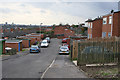
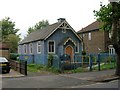
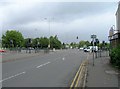

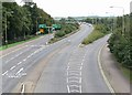
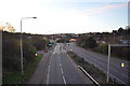

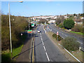


53 photos from this area
Area Information
Key information about the LE4 2AF including its size, population, and administrative classification.
- Area Type
- Postcode
- Area Size
- 1.0 hectares
- Population
- 1750
- Population Density
- 3831 people/km²
House Prices in LE4 2AF
28
Properties
£128,590
Average Sold Price
£74,950
Lowest Price
£190,000
Highest Price
Showing 28 properties
| Address | Type | Beds | Baths | Last Sale Price | Last Sale Date | |
|---|---|---|---|---|---|---|
| 370 Abbey Lane, Leicester, LE4 2AF | Semi-detached | 3 | 1 | £190,000 | Jun 2019 | |
| 366 Abbey Lane, Leicester, LE4 2AF | house | 3 | 1 | £145,000 | Feb 2017 | |
| 348 Abbey Lane, Leicester, LE4 2AF | Semi-detached | 3 | 1 | £133,000 | Oct 2016 | |
| 362 Abbey Lane, Leicester, LE4 2AF | house | - | - | £100,000 | Mar 2013 | |
| 344 Abbey Lane, Leicester, LE4 2AF | Detached | 3 | 1 | £74,950 | Nov 2003 | |
| 368 Abbey Lane, Leicester, LE4 2AF | Semi-detached | 3 | 1 | - | - | |
| 356 Abbey Lane, Leicester, LE4 2AF | house | 3 | - | - | - | |
| 352 Abbey Lane, Leicester, LE4 2AF | Terraced | - | - | - | - | |
| 360 Abbey Lane, Leicester, LE4 2AF | Semi-detached | - | - | - | - | |
| 388 Abbey Lane, Leicester, LE4 2AF | Flat | - | - | - | - |
Page 1 of 3
Energy Efficiency in LE4 2AF
Amenities
Schools
| Rank | School | Type | Entry gender | Ages |
|---|
Explore more schools in this area
Go to Schools tabDemographics
Household Size
One person
most common
Accommodation Type
Houses
most common
Tenure
27
majority
Ethnic Group
White
most common
Religion
N/A
most common
Household Composition
N/A
most common
Age
47
median
Adults (30-64 years)
most common
Household Deprivation
N/A
with no deprivation
NS-SEC
13
in Lower managerial occupations
Explore more demographic insights in this area
Go to Demographics tabPlanning
Planning Constraints
- Flood RiskPremium
- Ramsar Wetland SitesPremium
- Area of Outstanding Natural BeautyPremium
- Protected Nature ReservePremium
- Protected WoodlandPremium