Area Overview for LE4 0LL
Photos of LE4 0LL
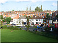
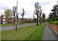
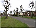
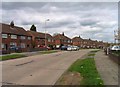
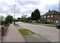
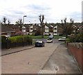
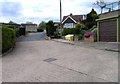
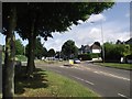
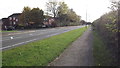
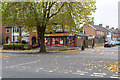
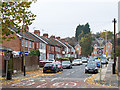
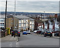
31 photos from this area
Area Information
Key information about the LE4 0LL including its size, population, and administrative classification.
- Area Type
- Postcode
- Area Size
- 3.2 hectares
- Population
- 1935
- Population Density
- 6100 people/km²
House Prices in LE4 0LL
46
Properties
£175,567
Average Sold Price
£97,500
Lowest Price
£290,000
Highest Price
Showing 46 properties
| Address | Type | Beds | Baths | Last Sale Price | Last Sale Date | |
|---|---|---|---|---|---|---|
| 89 Heacham Drive, Leicester, LE4 0LL | Semi-detached | 3 | 1 | £290,000 | Jun 2025 | |
| 93 Heacham Drive, Leicester, LE4 0LL | Semi-detached | 3 | 1 | £230,000 | Feb 2025 | |
| 99 Heacham Drive, Leicester, LE4 0LL | Semi-detached | 3 | 1 | £242,000 | Jul 2024 | |
| 157 Heacham Drive, Leicester, LE4 0LL | house | - | - | £265,000 | Jan 2023 | |
| 133 Heacham Drive, Leicester, LE4 0LL | Detached | 3 | 1 | £263,000 | Mar 2022 | |
| 135 Heacham Drive, Leicester, LE4 0LL | house | - | - | £192,500 | May 2021 | |
| 161 Heacham Drive, Leicester, LE4 0LL | house | - | - | £160,000 | Jul 2020 | |
| 131 Heacham Drive, Leicester, LE4 0LL | Semi-detached | 3 | 1 | £185,000 | Nov 2018 | |
| 97 Heacham Drive, Leicester, LE4 0LL | Semi-detached | 3 | 1 | £168,000 | Oct 2018 | |
| 119 Heacham Drive, Leicester, LE4 0LL | Semi-detached | 3 | 1 | £185,200 | Aug 2018 |
Page 1 of 5
Energy Efficiency in LE4 0LL
Amenities
Schools
| Rank | School | Type | Entry gender | Ages |
|---|
Explore more schools in this area
Go to Schools tabDemographics
Household Size
Family (3-5 people)
most common
Accommodation Type
Houses
most common
Tenure
77
majority
Ethnic Group
asian_total
most common
Religion
N/A
most common
Household Composition
N/A
most common
Age
47
median
Adults (30-64 years)
most common
Household Deprivation
N/A
with no deprivation
NS-SEC
19
in Lower managerial occupations
Explore more demographic insights in this area
Go to Demographics tabPlanning
Planning Constraints
- Flood RiskPremium
- Ramsar Wetland SitesPremium
- Area of Outstanding Natural BeautyPremium
- Protected Nature ReservePremium
- Protected WoodlandPremium