Area Overview for LE4 0JW
Photos of LE4 0JW
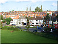
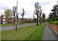
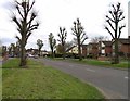
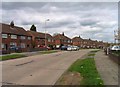
31 photos from this area
Area Information
Key information about the LE4 0JW including its size, population, and administrative classification.
- Area Type
- Postcode
- Area Size
- 4974 m²
- Population
- 1767
- Population Density
- 3543 people/km²
House Prices in LE4 0JW
18
Properties
£114,494
Average Sold Price
£39,950
Lowest Price
£245,500
Highest Price
Showing 18 properties
| Address | Type | Beds | Baths | Last Sale Price | Last Sale Date | |
|---|---|---|---|---|---|---|
| 8 Somerset Avenue, Leicester, LE4 0JW | house | - | - | £245,500 | Jan 2022 | |
| 24 Somerset Avenue, Leicester, LE4 0JW | house | - | - | £180,000 | Oct 2020 | |
| 36 Somerset Avenue, Leicester, LE4 0JW | Terraced | 3 | 1 | £168,000 | Mar 2018 | |
| 10 Somerset Avenue, Leicester, LE4 0JW | Semi-detached | 3 | 1 | £130,000 | Jun 2016 | |
| 30 Somerset Avenue, Leicester, LE4 0JW | Terraced | 2 | - | £108,000 | Feb 2014 | |
| 26 Somerset Avenue, Leicester, LE4 0JW | house | - | - | £99,000 | Oct 2009 | |
| 32 Somerset Avenue, Leicester, LE4 0JW | Terraced | - | - | £125,000 | Dec 2007 | |
| 28 Somerset Avenue, Leicester, LE4 0JW | Terraced | - | - | £117,000 | Apr 2007 | |
| 6 Somerset Avenue, Leicester, LE4 0JW | house | 1 | - | £142,500 | Nov 2004 | |
| 4 Somerset Avenue, Leicester, LE4 0JW | Terraced | 3 | 1 | £100,500 | Mar 2004 |
Page 1 of 2
Energy Efficiency in LE4 0JW
Amenities
Schools
| Rank | School | Type | Entry gender | Ages |
|---|
Explore more schools in this area
Go to Schools tabDemographics
Household Size
Family (3-5 people)
most common
Accommodation Type
Houses
most common
Tenure
67
majority
Ethnic Group
asian_total
most common
Religion
N/A
most common
Household Composition
N/A
most common
Age
47
median
Adults (30-64 years)
most common
Household Deprivation
N/A
with no deprivation
NS-SEC
21
in Lower managerial occupations
Explore more demographic insights in this area
Go to Demographics tabPlanning
Planning Constraints
- Flood RiskPremium
- Ramsar Wetland SitesPremium
- Area of Outstanding Natural BeautyPremium
- Protected Nature ReservePremium
- Protected WoodlandPremium