Area Overview for LE3 9QA
Photos of LE3 9QA
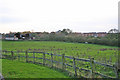
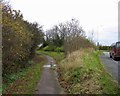
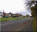
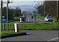
42 photos from this area
Area Information
Key information about the LE3 9QA including its size, population, and administrative classification.
- Area Type
- Postcode
- Area Size
- 1.4 hectares
- Population
- 2703
- Population Density
- 1501 people/km²
House Prices in LE3 9QA
59
Properties
£149,289
Average Sold Price
£82,250
Lowest Price
£330,000
Highest Price
Showing 59 properties
| Address | Type | Beds | Baths | Last Sale Price | Last Sale Date | |
|---|---|---|---|---|---|---|
| 43 Strathern Road, Leicester, LE3 9QA | Terraced | 2 | 1 | £226,000 | May 2025 | |
| 2J Strathern Road, Leicester, LE3 9QA | Flat | 2 | 1 | £125,000 | Apr 2025 | |
| 8E Strathern Road, Leicester, LE3 9QA | Flat | 2 | 1 | £130,000 | Jan 2025 | |
| 2F Strathern Road, Leicester, LE3 9QA | Flat | 2 | 1 | £140,000 | Nov 2024 | |
| 11 Strathern Road, Leicester, LE3 9QA | Semi-detached | 2 | 1 | £272,000 | Jun 2024 | |
| 4A Strathern Road, Leicester, LE3 9QA | Flat | 2 | 1 | £139,500 | May 2024 | |
| 3 Strathern Road, Leicester, LE3 9QA | Semi-detached | 4 | 2 | £270,000 | Jul 2023 | |
| 49 Strathern Road, Leicester, LE3 9QA | Detached | 3 | 2 | £325,000 | Jun 2023 | |
| 2E Strathern Road, Leicester, LE3 9QA | Flat | - | - | £125,000 | Mar 2023 | |
| 37 Strathern Road, Leicester, LE3 9QA | house | - | - | £330,000 | Aug 2021 |
Page 1 of 6
Energy Efficiency in LE3 9QA
Amenities
Schools
| Rank | School | Type | Entry gender | Ages |
|---|
Explore more schools in this area
Go to Schools tabDemographics
Household Size
Family (3-5 people)
most common
Accommodation Type
Houses
most common
Tenure
52
majority
Ethnic Group
White
most common
Religion
N/A
most common
Household Composition
N/A
most common
Age
47
median
Adults (30-64 years)
most common
Household Deprivation
N/A
with no deprivation
NS-SEC
32
in Lower managerial occupations
Explore more demographic insights in this area
Go to Demographics tabPlanning
Planning Constraints
- Flood RiskPremium
- Ramsar Wetland SitesPremium
- Area of Outstanding Natural BeautyPremium
- Protected Nature ReservePremium
- Protected WoodlandPremium