Area Overview for LE3 9PT
Photos of LE3 9PT
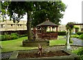
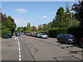
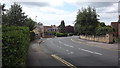
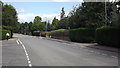
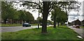
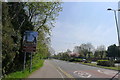

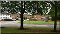
34 photos from this area
Area Information
Key information about the LE3 9PT including its size, population, and administrative classification.
- Area Type
- Postcode
- Area Size
- 2.0 hectares
- Population
- 1981
- Population Density
- 6382 people/km²
House Prices in LE3 9PT
43
Properties
£121,060
Average Sold Price
£12,500
Lowest Price
£207,500
Highest Price
Showing 43 properties
| Address | Type | Beds | Baths | Last Sale Price | Last Sale Date | |
|---|---|---|---|---|---|---|
| 69 Kemp Road, Leicester, LE3 9PT | house | - | - | £207,500 | Jul 2023 | |
| 17 Kemp Road, Leicester, LE3 9PT | house | - | - | £194,000 | Sep 2022 | |
| 83 Kemp Road, Leicester, LE3 9PT | house | - | - | £180,000 | Oct 2021 | |
| 9 Kemp Road, Leicester, LE3 9PT | Semi-detached | 3 | 1 | £151,000 | Apr 2021 | |
| 85 Kemp Road, Leicester, LE3 9PT | Semi-detached | 3 | 1 | £104,500 | Mar 2021 | |
| 47 Kemp Road, Leicester, LE3 9PT | Detached | 3 | 1 | £163,000 | Jan 2020 | |
| 81 Kemp Road, Leicester, LE3 9PT | Semi-detached | 3 | 2 | £130,000 | Nov 2019 | |
| 27 Kemp Road, Leicester, LE3 9PT | Semi-detached | 3 | 1 | £158,000 | Sep 2019 | |
| 55 Kemp Road, Leicester, LE3 9PT | Semi-detached | 4 | 1 | £120,000 | Apr 2017 | |
| 5 Kemp Road, Leicester, LE3 9PT | house | - | - | £104,000 | Oct 2015 |
Page 1 of 5
Energy Efficiency in LE3 9PT
Amenities
Schools
| Rank | School | Type | Entry gender | Ages |
|---|
Explore more schools in this area
Go to Schools tabDemographics
Household Size
Family (3-5 people)
most common
Accommodation Type
Houses
most common
Tenure
45
majority
Ethnic Group
White
most common
Religion
N/A
most common
Household Composition
N/A
most common
Age
47
median
Adults (30-64 years)
most common
Household Deprivation
N/A
with no deprivation
NS-SEC
14
in Lower managerial occupations
Explore more demographic insights in this area
Go to Demographics tabPlanning
Planning Constraints
- Flood RiskPremium
- Ramsar Wetland SitesPremium
- Area of Outstanding Natural BeautyPremium
- Protected Nature ReservePremium
- Protected WoodlandPremium