Area Overview for LE3 9GN
Photos of LE3 9GN
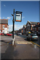
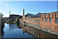
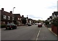
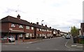
94 photos from this area
Area Information
Key information about the LE3 9GN including its size, population, and administrative classification.
- Area Type
- Postcode
- Area Size
- 5691 m²
- Population
- 1911
- Population Density
- 13818 people/km²
House Prices in LE3 9GN
50
Properties
£86,455
Average Sold Price
£13,000
Lowest Price
£170,000
Highest Price
Showing 50 properties
| Address | Type | Beds | Baths | Last Sale Price | Last Sale Date | |
|---|---|---|---|---|---|---|
| 12 Rowan Street, Leicester, LE3 9GN | house | - | - | £170,000 | Jul 2025 | |
| 70 Rowan Street, Leicester, LE3 9GN | house | 2 | 1 | £160,000 | Jan 2024 | |
| 94 Rowan Street, Leicester, LE3 9GN | Terraced | 2 | - | £138,000 | Nov 2023 | |
| 38 Rowan Street, Leicester, LE3 9GN | Terraced | 3 | 1 | £150,000 | Jul 2023 | |
| 98 Rowan Street, Leicester, LE3 9GN | Terraced | 2 | - | £145,000 | Mar 2021 | |
| 58 Rowan Street, Leicester, LE3 9GN | house | - | - | £143,000 | Dec 2020 | |
| 46 Rowan Street, Leicester, LE3 9GN | Terraced | 3 | 1 | £129,999 | May 2019 | |
| 2 Rowan Street, Leicester, LE3 9GN | Terraced | 2 | 1 | £114,000 | Mar 2019 | |
| 40 Rowan Street, Leicester, LE3 9GN | Terraced | 2 | 1 | £108,000 | Jun 2018 | |
| 18 Rowan Street, Leicester, LE3 9GN | Terraced | 2 | 1 | £100,000 | Feb 2017 |
Page 1 of 5
Energy Efficiency in LE3 9GN
Amenities
Schools
| Rank | School | Type | Entry gender | Ages |
|---|
Explore more schools in this area
Go to Schools tabDemographics
Household Size
Family (3-5 people)
most common
Accommodation Type
Houses
most common
Tenure
35
majority
Ethnic Group
White
most common
Religion
N/A
most common
Household Composition
N/A
most common
Age
47
median
Adults (30-64 years)
most common
Household Deprivation
N/A
with no deprivation
NS-SEC
16
in Lower managerial occupations
Explore more demographic insights in this area
Go to Demographics tabPlanning
Planning Constraints
- Flood RiskPremium
- Ramsar Wetland SitesPremium
- Area of Outstanding Natural BeautyPremium
- Protected Nature ReservePremium
- Protected WoodlandPremium