Area Overview for LE3 6FT
Photos of LE3 6FT
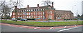
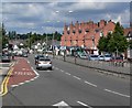
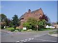
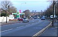
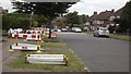
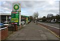
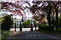
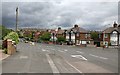
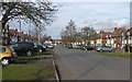
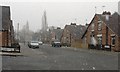
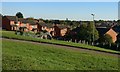
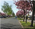
41 photos from this area
Area Information
Key information about the LE3 6FT including its size, population, and administrative classification.
- Area Type
- Postcode
- Area Size
- 5795 m²
- Population
- 1597
- Population Density
- 5290 people/km²
House Prices in LE3 6FT
20
Properties
£205,950
Average Sold Price
£33,500
Lowest Price
£355,000
Highest Price
Showing 20 properties
| Address | Type | Beds | Baths | Last Sale Price | Last Sale Date | |
|---|---|---|---|---|---|---|
| 16 Sunnycroft Road, Leicester, LE3 6FT | Semi-detached | 3 | 1 | £355,000 | Jan 2025 | |
| 2 Sunnycroft Road, Leicester, LE3 6FT | Detached | 4 | 3 | £310,000 | Aug 2020 | |
| 36 Sunnycroft Road, Leicester, LE3 6FT | Detached | 3 | 1 | £228,000 | Apr 2019 | |
| 20 Sunnycroft Road, Leicester, LE3 6FT | Terraced | 4 | - | £236,500 | Jun 2017 | |
| 10 Sunnycroft Road, Leicester, LE3 6FT | Semi-detached | 5 | 1 | £307,000 | May 2017 | |
| 46 Sunnycroft Road, Leicester, LE3 6FT | Detached | 4 | 1 | £220,000 | Jul 2016 | |
| 14 Sunnycroft Road, Leicester, LE3 6FT | Semi-detached | - | - | £218,000 | Nov 2006 | |
| 22 Sunnycroft Road, Leicester, LE3 6FT | house | - | - | £105,500 | Nov 2005 | |
| 12A Sunnycroft Road, Leicester, LE3 6FT | Flat | - | - | £33,500 | Mar 2003 | |
| 8 Sunnycroft Road, Leicester, LE3 6FT | house | - | - | £154,950 | Jul 2002 |
Page 1 of 2
Energy Efficiency in LE3 6FT
Amenities
Schools
| Rank | School | Type | Entry gender | Ages |
|---|
Explore more schools in this area
Go to Schools tabDemographics
Household Size
Family (3-5 people)
most common
Accommodation Type
Houses
most common
Tenure
75
majority
Ethnic Group
White
most common
Religion
N/A
most common
Household Composition
N/A
most common
Age
47
median
Adults (30-64 years)
most common
Household Deprivation
N/A
with no deprivation
NS-SEC
40
in Lower managerial occupations
Explore more demographic insights in this area
Go to Demographics tabPlanning
Planning Constraints
- Flood RiskPremium
- Ramsar Wetland SitesPremium
- Area of Outstanding Natural BeautyPremium
- Protected Nature ReservePremium
- Protected WoodlandPremium