Area Overview for LE3 6DZ
Photos of LE3 6DZ
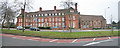
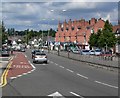
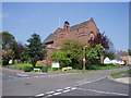
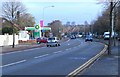
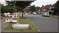
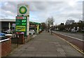
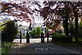
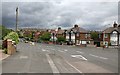
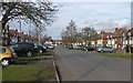
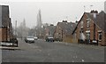
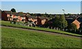
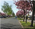
41 photos from this area
Area Information
Key information about the LE3 6DZ including its size, population, and administrative classification.
- Area Type
- Postcode
- Area Size
- 1.1 hectares
- Population
- 1621
- Population Density
- 5660 people/km²
House Prices in LE3 6DZ
31
Properties
£272,100
Average Sold Price
£83,000
Lowest Price
£455,000
Highest Price
Showing 31 properties
| Address | Type | Beds | Baths | Last Sale Price | Last Sale Date | |
|---|---|---|---|---|---|---|
| 13 Gimson Road, Leicester, LE3 6DZ | Semi-detached | 4 | 1 | £400,000 | Jun 2024 | |
| 43 Gimson Road, Leicester, LE3 6DZ | Detached | 4 | 2 | £360,000 | Dec 2023 | |
| 19 Gimson Road, Leicester, LE3 6DZ | house | - | - | £440,000 | Mar 2023 | |
| 39 Gimson Road, Leicester, LE3 6DZ | house | - | - | £347,000 | Apr 2022 | |
| 21 Gimson Road, Leicester, LE3 6DZ | house | - | - | £455,000 | Jun 2021 | |
| 51 Gimson Road, Leicester, LE3 6DZ | house | 3 | - | £255,000 | Dec 2018 | |
| 33 Gimson Road, Leicester, LE3 6DZ | house | - | - | £220,000 | Dec 2018 | |
| 1 Gimson Road, Leicester, LE3 6DZ | Flat | 1 | - | £307,000 | Oct 2018 | |
| 49 Gimson Road, Leicester, LE3 6DZ | Detached | 4 | - | £261,000 | Dec 2016 | |
| 37 Gimson Road, Leicester, LE3 6DZ | Detached | 4 | - | £240,000 | Nov 2016 |
Page 1 of 4
Energy Efficiency in LE3 6DZ
Amenities
Schools
| Rank | School | Type | Entry gender | Ages |
|---|
Explore more schools in this area
Go to Schools tabDemographics
Household Size
One person
most common
Accommodation Type
Houses
most common
Tenure
58
majority
Ethnic Group
White
most common
Religion
N/A
most common
Household Composition
N/A
most common
Age
47
median
Adults (30-64 years)
most common
Household Deprivation
N/A
with no deprivation
NS-SEC
26
in Lower managerial occupations
Explore more demographic insights in this area
Go to Demographics tabPlanning
Planning Constraints
- Flood RiskPremium
- Ramsar Wetland SitesPremium
- Area of Outstanding Natural BeautyPremium
- Protected Nature ReservePremium
- Protected WoodlandPremium